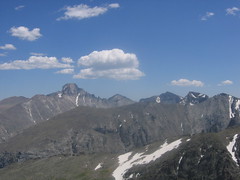
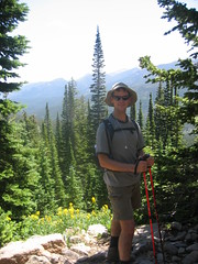
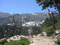
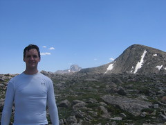
Dennis & I hiked to the top of Hallet’s Peak (above) via Flattop Mountain (Below). The 10 mile hike took us 5.5 hours (11:30am to 5pm) and we had about 3,400′ of elevation gain.
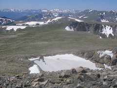
I wonder why Flattop is distinguished as a separate mountain, when it seems to me it is a plateau. What are the USGS specifications for classification of mountains?
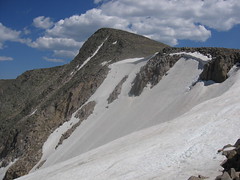
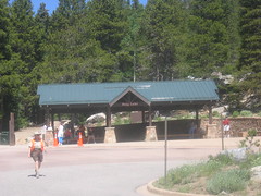
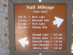
We took the free shuttle from the Bear Lake overflow lot to the Bear Lake TH. We followed the signs to the top of Flattop Mountain (Amazingly Flat!), and then made the quick traverse over to Hallet’s 2nd class finish.
The trail up to Flattop was frequented by all sorts of people. I saw mountaineers, weekend campers, hikers, everyday flatlanders, photographers, Europeans, teenagers without supervision, adults without supervision, and a crusty, overweight old dude from South Dakota.
Along the way, we ran into these two French dudes who were really friendly. They were in Denver on business and decided to head up to the Mountains to escape the heat. One was wielding a laptop in a briefcase, and the other a plastic “Gap” bag full of 1 water bottle, and snacks.
As Dennis & I passed them, I asked, “Did we pass a Gap Store. If so, I must have missed seeing it next to the trail.”
The French Dudes Laughed.
Their comeback: “We are headed up to the lake. If location looks good, we will email the GAP company and request a new location!”.
I thought, “Dear Lord, No!”. I hope they were joking.
As we all hiked along, I noticed them keeping up with my grueling pace, so I was amazed.
Later, they proclaimed I was “running”. As if!!! I can’t help it if they can’t keep up…hee-hee. So the cheerful banter went on like this for awhile.
The trail splits about a mile into the hike and one fork goes to the lake (easy way), the other goes to Flattop (the more challenging way). Of course, we were going to Flattop.
The French Dudes were asking us about snow up in the higher elevations, as the Ranger had warned them about it. (They were just wearing sneakers). I told them that they should just hike up as far as is prudent, because the view would surely be worth the effort.
I also explained that the Rangers always assume one is in the worst possible shape, and I explained to them that since they were keeping pace with us, they’d probably be fine.
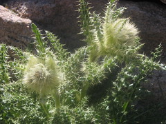
Not only was there not a lick of snow, we had beautiful wildflowers and thistles!

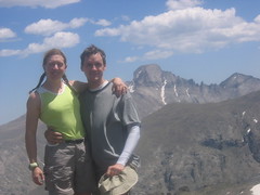
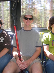
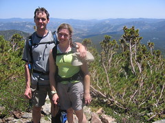
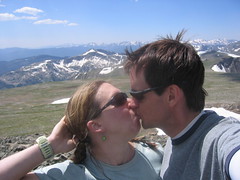
In the end, the French Dudes walked along with us and they kept making us laugh. And, they took this nice picture of Dennis & I…
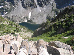
So, once on top of Flattop, the top of Hallet’s is only half a mile away.
It takes about an hour total to walk up to the summit of Hallet’s and back to Flattop. Since it was 1:30pm, and the weather was great-we went for it.
So happy we did because the view up there was just awesome…unobstructed vision of Long’s, Pagoda, and McHenry’s Peaks. As well as beautiful sweeping vista of the Continental Divide. How wonderful!