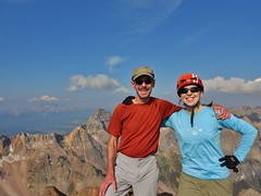
Victorious on Mt. Sneffels (14,157 ft)
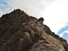
Jeff Scrambling up to the Summit of Mt. Sneffels
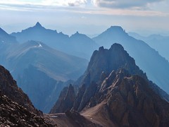
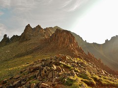
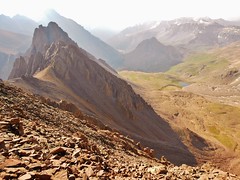
The Amazing View! Cirque Mountain, Teakettle Mountain, and Potosi Peak.
Jeff and I climbed the uber classic southwest ridge of Mt. Sneffels.
Jeff had mentioned, on my Pigeon/Turret trip last summer, how he was interested in climbing the ridge route on Sneffels. In the meantime, I had heard nothing but good things about it from other folks in the Colorado Mountain Club.
So, finally, after thinking and dreaming about the route for year, I got to climb it! The southwest ridge did not disappoint; it truly is a classic ridge scramble and, as such, is featured as one of the premier routes in the CO Scrambles book.
On Saturday night, we left Jeff’s place in Telluride and drove the 40 minutes to the trail head in Yankee Boy Basin.
We drove through Ouray and I thought, “Hmmmm, this is a cute little town. I’ll have to come back and check it out sometime.”.
After passing through town, we continued down the gravel road all the way to the upper parking with the bathroom, at 11,330 ft. There were a few moments of excitement, but Jeff’s Subaru Outback made it no problem.
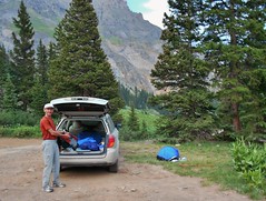
We promptly set up sleeping accommodations. Notice my blue bivy to the right of the Subi!
I love my bivy, except when it rains. And rain, it did. Over the course of the night, it rained for 15 minutes on the hour, almost every hour!
When it’s raining, the water from the bivy drips on my face, so I have to roll down the flap to avoid getting wet. Then, it gets unbearably humid inside the bivy from breathing. Thus, that night, I only got a couple hours sleep, because I was constantly unrolling and re-rolling the flap.
It’s nice having a bivy because it saves a lot of weight. After this experience in the San Juans, I think I’m in the market for a one person tent. Or some sort of tarp system.
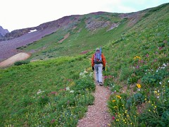
The morning came soon enough. The birds were in an uproar, I couldn’t believe the symphony of chirping!We walked down the gravel road, lined on both side by a verdant abundance of wildflowers, until we saw a sign and a diverging single track.
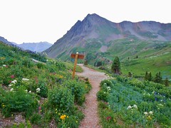
The trail finally turns single track, after 30 minutes on the road!
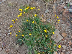
The area was inundated with blooming flowers, so we both really enjoyed this part of the trail!
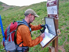
Jeff signing the register.
After the register, the trail ascends steeply towards Wrights Lake.
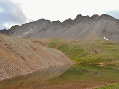
Wrights Lake and the jagged southwest ridge of Mt. Sneffels!
We hit Wrights Lake (12,180 ft) about 15 minutes after signing the register. The view of Sneffels from here looks impressive. I was even more excited about the route now that I could see it in person!
Jeff going up Blue Lakes Pass. It took us about 1 hour and 20 minutes to get here. The sun came out and it felt really nice.
Blue Lakes Pass. See Dallas Peak in the background and Blue Lakes down below.
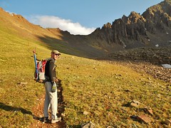
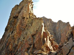
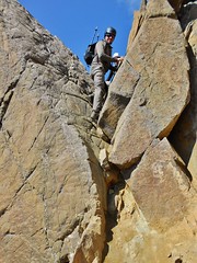
The Southwest Ridge. There was a party of 2 in front of us a ways. We could see them when we started. We were happy they were just as fast as us…so no worries about them knocking rocks down.
Turn right at this notch! It took us about 2 hours 10 minutes to reach this notch.

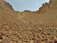
Go up this gully. Follow the cairns. If it gets too hard, you went the wrong way!
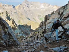
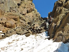
Jeff enjoying the scrambling. At the top of a gully. About 2.5 hours into our climb.
Kissing Camels. It took us 2 hours and 40 minutes to get to the camels.
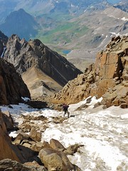
The Lavender Col, taken from near the summit of Sneffels. That’s the way down, folks!
Looking back at Blue Lakes Pass
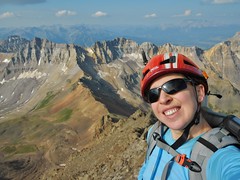
On the Summit of Mount Sneffels at 8:53am, 3 hours from the Trail Head.
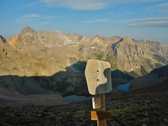
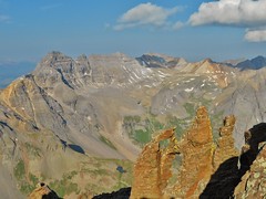
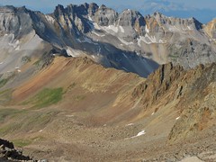
Dallas Peak and the Wilson Group from the Summit of Mt. Sneffels
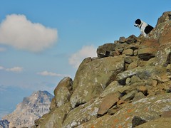
I love this picture of a dog on the summit of Sneffels!
Crux Down/Upclimb of the standard route on Sneffels. It was a one move boulder problem. We had no problem negotiating the move.
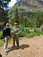
I met Beth and Mark on the summit. Beth was finishing her Centennials…super awesome. She met Mark on her hike up and he’s also a super nice fellow peak bagger.
Jeff Going down the standard route.
Looking back up at the Lavender Col. It was fun going down, but I definitely do not ever want to hike up it!

Looking back at Mt. Sneffels from just below the 4WD parking lot, above 12K feet.
Back at the car. We did the whole Sneffels loop in 6 hours. What a great hike! I had a blast climbing with Jeff and meeting Beth and Mark.
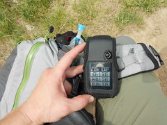
My stats from the GPS receiver.
Tags: 14er, Centennials, Mountaineering, Mt.Sneffels, Southwest Ridge