Erin and I had a fabulous plan for the upcoming weekend adventure. First, drive to the Sawatch Mountains and climb a 14’er. Second, attend the 17th Annual Colorado Brewer’s Rendezvous in Salida.
We wondered, how could we have a more perfect weekend?
We selected Mt. Antero as the target, with Cronin Peak, a Centennial 13’er as a bonus. These peaks are relatively close to Salida, we had not climbed them yet, and we *thought* we had a good chance of driving to the higher trailhead (Erin’s friend had recently driven up to the 4wd lot in her Subaru).
Unfortunately, my Subaru overheated on the way to Erin’s house. So, I left it somewhere in Lakewood, for Dennis to sort out later (thanks, hun!). Driving in her RWD truck, would we reach the 4wd lot? Would we be hiking up Baldwin Gulch in the dark and tacking on an extra 5 or 6 miles, round trip?
Driving up Baldwin Gulch Road, to the 10,800 ft level, in a Subaru Forester is definitely possible in summer. Scanning through the 14’ers site, in the month of July, there have been a few people who have completed this feat. However, since we were in the RWD Mazda pickup *and* it had rained quite a bit the night before, we were not so fortunate.
We got about 1/4 to 1/3 of a mile up Baldwin Gulch road before losing momentum and spinning the wheels. We tried stacking rocks behind her rear wheels, but the ground underneath was too muddy and soft, so the rocks just moved when she accelerated. We finally gave up and realized it was futile to keep trying.
It was starting to get dark, so we decided to park the truck on the side of the road and hoof it. Grumpy and defeated, we started walking up Baldwin Gulch around 7:30pm. It is a steady, uphill and slightly muddy, gravel coated road. It narrows in places, with some impressive drop-offs.
After walking about 1.5 miles, we could hear running water and realized there was a creek down below and to our left. We broke out the headlamps as it was now very dark, but the creek was too far down below to see it.
Another hour later, we saw a Subaru parked in the forest off to the left and marveled at how it got to that parking spot. It seemed to be completely surrounded by trees!
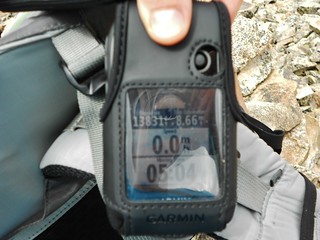
Around 10pm, we got to the creek crossing and decided to pitch the tent right there, at ~10,800 ft. We were both oh-so-happy to get to sleep.
Our alarms sounded at 4:30am. We decided to luxuriate for a few extra minutes. Ever the morning person, Erin arose first. She noshed on a very large pastry (~6 inches by 12 inches)!. I must confess, the night before, I was eyeing that pastry…thinking I’d steal a bite in the morning. But, when morning arrived, I just couldn’t stomach eating it, or anything. I guess it was too early.
We left camp at 5:30am. It was a beautiful morning, everything you could ask for in the mountains! Cheerful birds and abundant wildflowers, we had just barely missed their peak bloom.
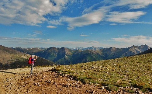
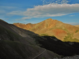
Taken about 40 minutes from camp, at 10,800 ft.
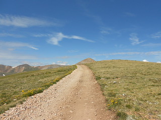
Erin hiking up the long, gravel road.
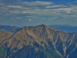
Cronin Peak, taken from the same place as the picture above!
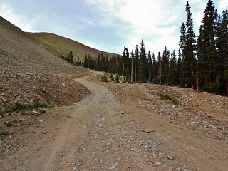
As we walked up the gravel road, it soon turned into a grind. Both of us spent a fair bit of our childhood in a rural setting, so gravel roads tend to be pretty boring. I was longing for a trail, but it was not meant to be! About 90% of the hike up Mt. Antero is on a gravel road! It wasn’t until I deviated to explore Cronin Peak that I was rewarded with an “off road” experience.
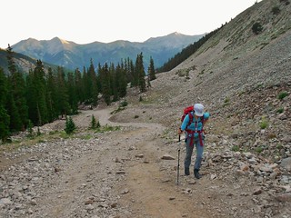
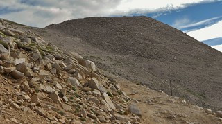
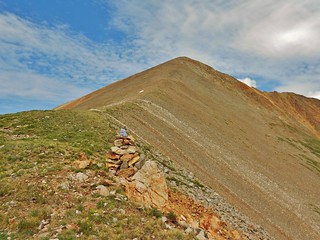
Cronin Peak, at 7:30pm. We had been hiking for 2 hours now. Clouds are already forming…!
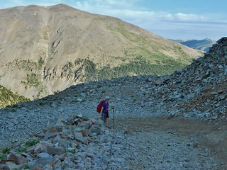
The road from the same spot as the picture taken above. We took a little snack break here.
Around 8:15am, with about 1000 feet of altitude left, and less than a mile horizontally, from the summit of Antero, I noticed weather beginning to build up. I was bummed it was happening so early in the day!
Clouds over the subpeak of Antero.
Erin taking a breather on the way up to Antero (taken from the same spot as the picture above).
Since I was intending to climb Cronin Peak, in addition to Antero, I needed to solve a math problem…How fast do I need to go, in order to complete both peaks before the pm thunderstorms materialized?
It was about 1 mile to finish Antero, 3.7 miles to summit of Cronin, plus another 2 miles back to the saddle. That’s 6.7 miles total. If the thunderstorms come in at noon (I could be so lucky, if they held out that long!), then I had 3 hours and 45 minutes of time. This equates to ~33 minutes per mile pace (regardless of altitude or steepness of the hike).
In reality, I needed to go much faster, to ensure that I could avoid the crash/bangs…So, I decided to speed up.
Mount Antero. Yay, no more gravel road and a bit of scrambling to boot!
Mt. Princeton from Mount Antero
As I scrambled up the final bit of Antero, I looked back to make sure Erin was okay. I could see a little dot of red where the 4wd road ended, so I was happy she was still trucking along at her own pace.
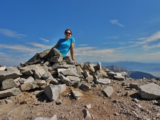
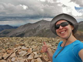
At 9:25am, I was on the summit of Antero and immediately headed back down.
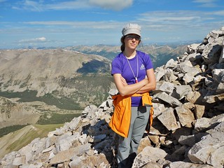
On my way down, at 9:43am, I ran into Erin as she made her way up the last 100 feet of Antero. She was still not feeling all that great, but happy to be bagging another peak. I admired her fortitude and resolution!
I gave her one of the radios and we decided to contact each other at 10:30am, for safety purposes. In order for this to work, we needed line of sight between the radios.
Erin, about to summit, taken at 9:55am…look for the orange dot at the top!
It was time to RUN back down to the saddle between Cronin and Antero. It was over a mile away and 1000ft down and I had less than an hour to get there! On the steep bits, I jogged, but when it flattened out and I was back on gravel, I picked up the pace. I passed some folks on their way up to the summit and they just shook their heads at the crazy girl (me!) plowing down the mountain.
I made it to the saddle with about 5 minutes to spare. While I was waiting for 10:30am to arrive, I noshed on some string cheese and a fruit leather. Yum!
I called Erin and she reported to have had a nice time on the summit. She loitered up there, just so that we could have the conversation with line of sight, and was excited to be heading down.
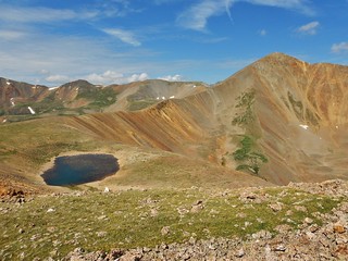
Cronin Peak, taken about half a mile southwest of the saddle.
We arranged to have another conversation at noon, by which time I hoped to be off of Cronin Peak. We were both a bit nervous about the weather. I vowed to keep my eye out and not go for the summit if it became imminent.
As soon as I signed off the radio, I started running over to Cronin Peak. I ran ~11 minutes per mile pace, and got to the base of Cronin Peak at about 11am, see the picture above!
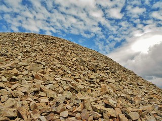
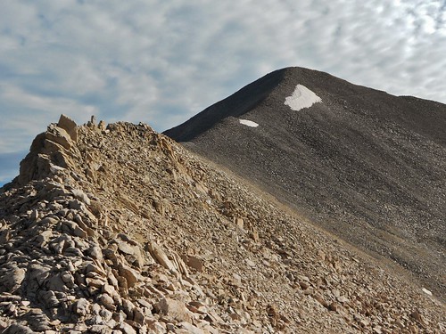
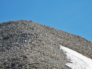
By 11:15am, I was halfway up Cronin Peak. Big dinner sized plates of rock covered Cronin Peak (or is this what makes up the peak, itself?). For the most part, it was stable footing, except for the last 100 ft, which would sometimes shift as one large mass underneath my feet.
I summited Cronin Peak at 11:37am, having travelled 8.7 miles from our camp.
Looking back at Antero, I noticed a huge dark thunderhead looming! I heard some rumbles and then started running back down Cronin.
I called Erin at noon. By this time, I was just about to be off of Cronin Peak, with only about 100 ft left of the descent.
Unfortunately, I was still about 2 miles from Erin, who was waiting nervously at the saddle of Cronin Peak and Antero. As she was much closer to the threatening weather system, she suggested hightailing it downhill. I couldn’t agree more!
Before she signed off, she told me she met some interesting Miners and had some stories to tell me later! (Erin is a librarian, so if she has stories, you know they’re going to be good!) In any event, we agreed to meet later and in a safer environment, down at treeline.
When I signed off the radio, I started jogging again.
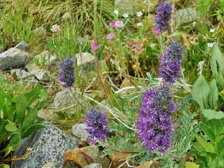
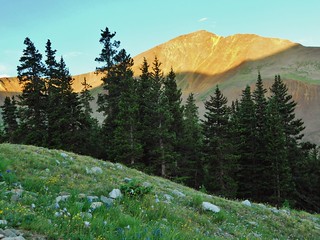
Pretty flowers at tree-line.
I reunited with Erin around 1:15pm. In a light drizzle, we walked briskly back to camp. It stopped raining just before we finished packing, so that was nice. It was also neat to walk down Baldwin Gulch Road in daylight and see all the stuff we missed by walking up it in the dark!
We reached the truck around 3:30pm and had a bit of an adventure backing the truck down Baldwin Gulch road. Erin was a real trooper, as we met up with some questionable 4wd’ers who were not very nice when they saw us backing down the road.
We were both so happy to have had our adventure and survive, truck in tact, that we gave each other high-fives when we got back down to Chaffee County 162.
It was definitely time for frosty beverages and dinner! We decided to go to Amico’s in Salida, where I onsighted the baked spaghetti dish. After dinner, we truck camped along the road to the Mt. Shavano trail head. We found a secluded spot, had some moonshine and Izzy’s blackberry soda, and played adult Mad Libs on Erin’s IPAD. How fun and what a great way to end the day!!!
All in all, I hiked ~21 miles (with ~5,800 ft of gain) for Antero and Cronin. Erin did ~16 (with ~4,900 ft of gain). Tomorrow, we would celebrate our success at the 17th Annual Colorado Brewers Rendezvous. We definitely earned it!
Tags: 13'er, 14er, Baldwin Gulch Road, Centennial, Cronin Peak, Mount Antero