
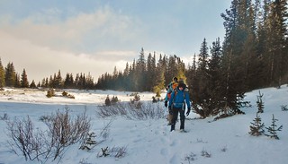
David, Jane, and Sonja Ascending the East Ridge in Gale Force Winds
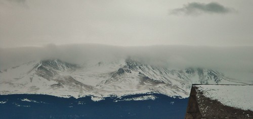
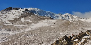
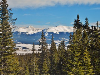
Mt. Massive (Taken the day before!). The Lower portion of the East Ridge is blown free of snow.
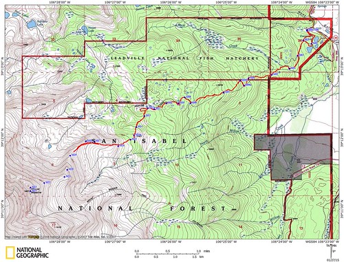
Our Route, the East Ridge, (Failed Attempt in Red).
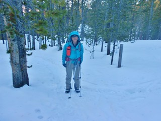
The Crew: Jane, David, Sonja, and myself.
Launch Time: 6am
High Point Turnaround: 11:40am (from ~12,700 ft)
Trench Contribution: (~1 mile)
Return to Fish Hatchery: 3:10pm (~9,620 ft)
We enjoyed a fabulous winter day in the beautiful mountains of the Sawatch. We had high hopes for summitting Mt. Massive, but were thwarted by gale force winds up high on the East Ridge.
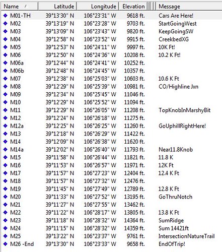
The Waypoints!
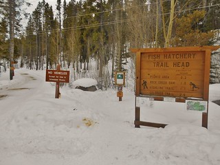
Leadville Fish Hatchery Trail Head Signage
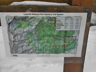
The Fish Hatchery Trail Map (it’s a buck if you want to buy one). The trails in the area can be a bit confusing at oh-dark-thirty, so if you don’t have waypoints, it might be handy to have this map!
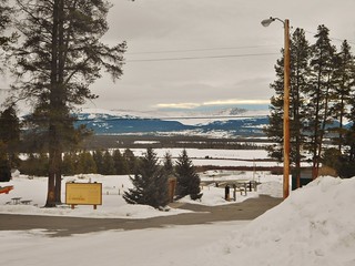
Looking back at the main road, from the trail head. It’s north east, from the vehicle parking.
You can either take the road, or the nature trail, to the highline trail. The nature trail is to the right of frame and directly starts climbing, from right behind the trail head sign. The road is more gentle, but it does curve a bit extra to the south…but, no matter which way you go, you will end up meeting an intersection at 39 deg 13′ 22” N by 106 deg 23′ 27” W.
Start at 6am.
If I ever try this again, I will start at 5am. We wanted to start a bit later so that we would hit the Massive Wilderness Kiosk just as it became light. Now that I know the way, I think it would be better to hit the Highline/Colorado Trail intersection at sunrise.
Sonja – Trailblazing the way forward. She led the way for much of the first half of the hike. What a strong hiker!
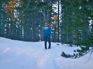
Jane – Waiting for her chance to shine…And, boy, did she ever.
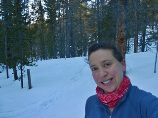
Climbergirl with Rosy Cheeks! Here I am, ever hopeful that the wind will die down!
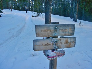
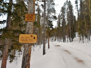
The Highline and Colorado Trail Intersection Signs. I brought my sneakers just in case my LaSportiva Nepal Evo mountaineering boots became unbearable on the way back. It is about 3 miles to get to this intersection, from the Fish Hatchery trail head. The path is totally packed, from the cross country skiers and snowshoe hikers.
If I ever try this again, I will cross country ski all the way to the South Ridge. It would be an awesome trip back to the car!
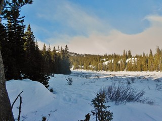
About 1 hour after the Colorado trail, it was my turn to shine. We weaved in and out of the trees and between several little lakes or ponds. At one point, we were on a bump at Pt 11,220ft and I took the time to point out our next destination…looking south, you can see Pt 11,827ft.
From the bump at 11,220, the trail dips down into a marshy area and the trail was lost, from wind. I proceeded to follow waypoints, in my Garmin, to determine when and where we start climbing up to Pt 11,827.
The waypoints I had programmed, led us to go almost all the way to the west end of the marshy area. Then, it pointed us to turn left and ascend towards the Southeast.
I turned around at the (now known, best approximate spot for ascent) and took the picture above.
Then, I turned towards the west (we actually went a little bit ***more*** west than this picture, before we went up):
We discovered that you only need to go about halfway to the west end of the marshy bit, prior to making the ascent.
If I ever do it again, I will turn left and head uphill (southward!) at:
39 deg 12′ 25” N by 106 deg 26′ 25” W

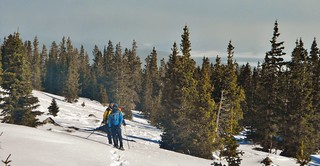
Once we decided to go uphill, David charged ahead and spent the next hour in the lead. He picked an excellent line up the steep slope, until we got to just below Pt 11,827ft. Then, it was Jane’s turn to shine and she took over for the next 30 minutes until we were on the East Ridge.
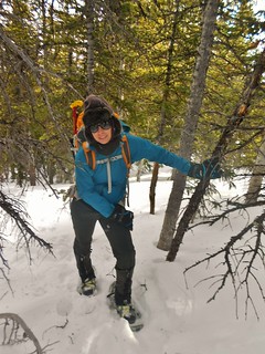
Sonja climbing the steeps.
Pt 11,827 ft
When we got to Pt 11,827, I thought we’d be on the ridge. Almost! We had a bit more climbing to do and it was still forested for the next 20 minutes. This picture was taken to the Southwest. You can see Jane’s tracks, freshly imprinted.
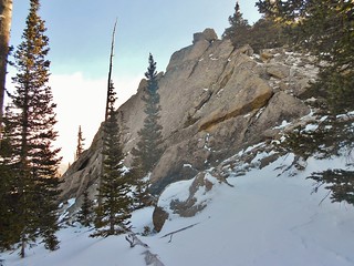
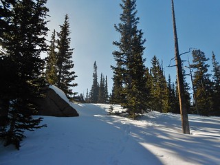
Finally, after a solid 4 hours of hiking, the trees are starting to thin and we can see part of the ridge! We’re still not on the ridge proper, as we have to climb a steep snowbank (behind the last clump of trees), to get to 12,000 ft.
From the same spot as the last picture, I turned around and got this one of Sonja and David.
However much the wind was howling in the trees, it was 10 times worse once we emerged on the ridge. I took advantage of the last clump of trees to put on my wind pants, windbreaker, and eat a snack. I felt like I was preparing for battle. And I was.
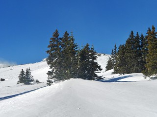
After climbing to 12,000 ft, it was clear we wouldn’t need the snowshoes. The ridge was fairly well scoured of snow and where it wasn’t, there were options to walk on rocks. David decided to take his snowshoes, but the rest of us stashed and dashed. I took this picture as we placed our snowshoes by the rock on the lower left of frame. I also took a GPS waypoint of the storage location, just in case.
The East Ridge of Mt Massive, in Gale Force Winds. If you look closely, you can see Sonja’s grey and orange backpack, David’s Yellow parka, and Jane is the blue dot way out in front.
From this spot, I went another 40 minutes, until I was at ~12,700-12,800 ft. We were getting tossed around quite a bit by the wind. If an outsider would have seen us from a distance, they would have thought we were drunk. One moment, I’d be facing west and leaning into the wind and another moment, I’d be facing north and pushed up against a boulder. It was awful to have to yield, I didn’t want to. Every part of me was saying keep going…other than the wind, it was gorgeous. Conditions on the ground were perfect. It felt absurd to keep going and yet, annoying to turn around.
Sonja was the voice of reason. There’s always somebody who says it first, “This is just not fun. This is dangerous.”. I’m paraphrasing because I’ll never know exactly what she said…Even though my face was 3 inches from her face, I still couldn’t hear her…the wind was so bad!
So, we two ladies headed downhill while Jane and David pushed forward. They eventually resorted to crawling, before coming to the same realization as Sonja and I. It just wasn’t worth the danger.
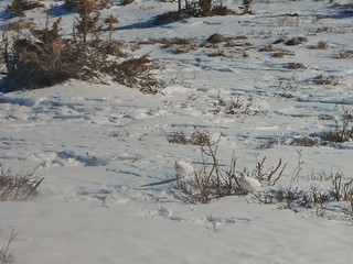
On the way down, we saw some very large cat pawprints, up above our snowshoes (~12,200 ft). We also saw some ptarmigan, down lower, on the edge of treeling (~11,900 ft). It was cool to see the little birdies as they were completely white!
Sonja took this nice picture of me on our way down. I am not smiling.
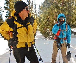
We all reconvened just below Pt. 11,827 and had a short discussion of the wicked wind and of our dumb luck. One thing we had all agreed on was that we made the right decision and we were happy to be safe.
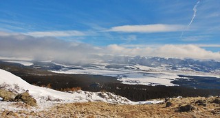
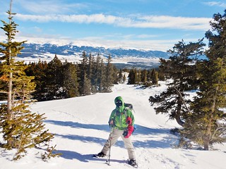
Pretty views of the Mosquito Mountains as we descended back to the Highline Trail!
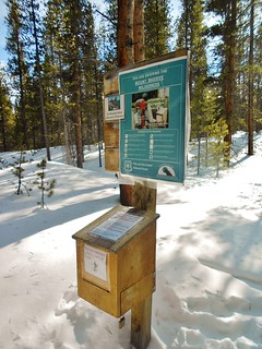
The Massive Wilderness Permit Kiosk. Remember to fill out and take a permit! It’s free, but make sure to have one with you. It’s about 1.25 miles from the Fish Hatchery Trail Head.
Tags: 14er, CO, East Ridge, Leadville, Leadville Fish Hatchery, Mountaineering, Mt. Massive, Sawatch Mountains, Snowshoe Hiking