Posts Tagged ‘Snowshoe Hiking’

Mountaineering – Humboldt Peak (14,064 ft)

Friday, February 13th, 2015

Charlie's Angels on Humboldt Peak
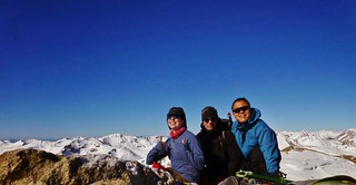
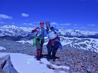
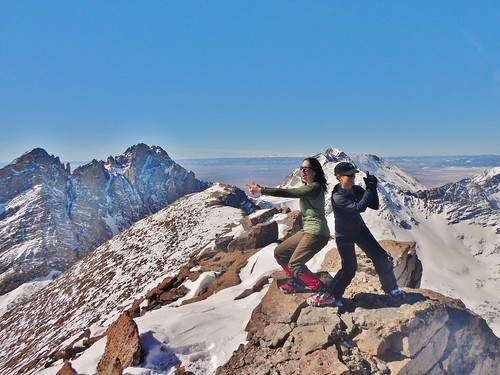
Jane and I do our impression of Charlie’s Angles. The Third Angel took a hike!

Happy on Humboldt
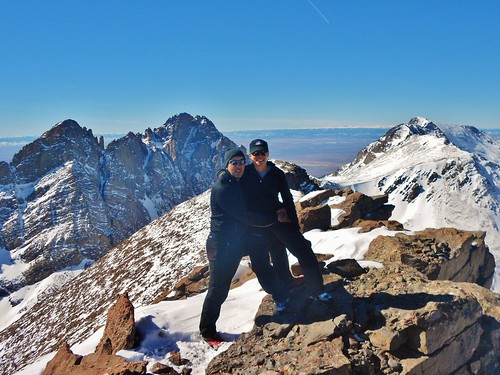
David and Jane on the summit of Humboldt Peak.

Humboldt Peak East Ridge Topographic Map
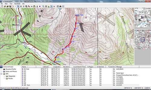
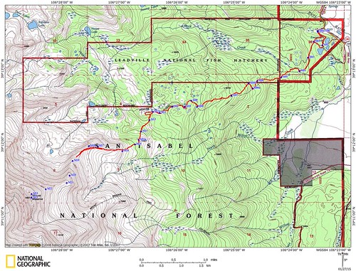
Topographic Map of Humboldt Peak

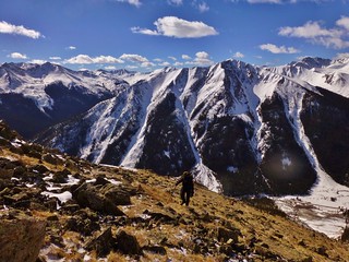
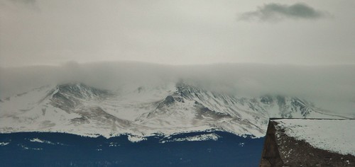
The rest of the state was being pummeled by strong winds, snowstorms, and laden with avalanche hazards. David, Jane, and I were looking for some place to go where we could safely summit a peak and it seemed the Crestones might just be the solution.

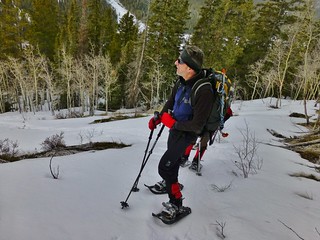
Jane has already climbed all the 14ers, but when there is opportunity to climb one in winter, she’s game! And, since I had not done Humboldt before, it looked like a great idea. I booked a room for the three of us in the tiny town of Crestone; so on Friday we drove down and arrived at bedtime. We made some tea and gathered our gear for the next day.

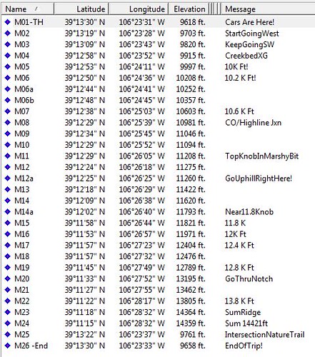
Would the mild forecast hold out? Would we make the summit? With a half marathon distance and over 5,400 ft of gain, it was bound to be a long day! What would the snow be like; would it be post hole madness or nice consolidated crunching?

(more…)

Mountaineering – Lackawanna Peak (13,823 ft)

Sunday, February 8th, 2015

Lackawanna Peak Summit Picture
Clare, Tom, and Frank on the summit of Lackawanna Peak

Climbing South Slopes of Lackawanna
At ~12,000 ft on the direct south slope of Lackawanna

Tom Climbing Lackawanna
Tom climbing the lower slopes of Lackawanna. You can see hwy 82 below him.

Lackawanna Peak Topographic Map and Waypoints
The Route and GPS Waypoints

Good times were had by Tom, Frank, and Clare on the Lackawanna legburner route, which was climbed on Sunday. The 4 mile round trip journey featured 3,450 feet of gain! It took us 6 hours to get up the peak (mainly due to the deep snow over the first half of the route) and 4 hours to get down. I was very thankful to Frank, who both supplied the pictures and drove us there!

(more…)

Mountaineering – Mt. Massive via East Ridge, A Winter Attempt

Sunday, January 25th, 2015

Mt Massive East Ridge
David, Jane, and Sonja Ascending the East Ridge in Gale Force Winds

Sneak Preview of Massive
Mt. Massive (Taken the day before!). The Lower portion of the East Ridge is blown free of snow.

Mt. Massive East Ridge - Topographic Map
Our Route, the East Ridge, (Failed Attempt in Red).

The Crew: Jane, David, Sonja, and myself.
Launch Time: 6am
High Point Turnaround: 11:40am (from ~12,700 ft)
Trench Contribution: (~1 mile)
Return to Fish Hatchery: 3:10pm (~9,620 ft)

We enjoyed a fabulous winter day in the beautiful mountains of the Sawatch. We had high hopes for summitting Mt. Massive, but were thwarted by gale force winds up high on the East Ridge.

Mt Massive East Ridge GPS Waypoints
The Waypoints!

(more…)

Mountaineering – Mount Silverheels (13,822 ft) via Northwest Ridge

Sunday, June 1st, 2014

Silver Heels on Mount Silverheels
Clutching our Silver Heels on the Summit of Mount Silverheels

According to summit post, “Mount Silverheels was named after a dance hall girl who during an epidemic of smallpox, was the only woman who stayed in town and took care of the ailing miners. Because of this altruistic act, you could say that Silverheels is literally and figuratively a very beautiful mountain.”

I previously attempted Mount Silverheels on March 30th, but turned around due to winds in excess of 100 mph. In those treacherous conditions, I thought of Mount Silverheels as a malicious and vindictive mountain. It was not at all “a very beautiful mountain”!

However, it was my birthday and I was determined to greet the mountain, and the upcoming year, with a renewed optimism. So, I enlisted the help of my friend Jenny, who is seriously one of the most altruistic persons I have known. With patience and open minds, we attacked the mountain!

(more…)

Snowshoe Hiking – Mount Saint Vrain (12,162 ft)

Saturday, February 22nd, 2014

CMC Snowshoe Hike of Mount Saint Vrain
Rick, Clare, Mike, and Roger at the Trail Head
Photos courtesy: Rick Casey

On Saturday, I co-led a Colorado Mountain snowshoe/ski trip. Our destination was Mount Saint Vrain, a popular backcountry snowshoe/ski area in the Indian Peaks Wilderness. On a clear day a view from the top includes a multitude of beautiful peaks, such as Mt. Audubon, to the south, and Longs Peak, to the north.

Since it was the middle of winter, we merely wished for good weather. If we saw the summit, then it would just be a big bonus!

Our wish was not granted. Light snow showered us as we walked through the forested path. A hearty gust of wind intermittently caught us off guard. As we approached tree line, we took out the map to make sure we were headed in the right direction. (more…)