Every weekend, there are hundreds of people summitting Mt. Bierstadt via the standard West Slopes, from Guanella Pass. I was purposely putting off climbing Mt. Bierstadt because of my dislike for encountering hoards of people in the wilderness. Back in 2008, I had climbed Mt. Evans via the 2nd Apron and that was super fun…until I got to the summit and encountered the masses.
In talking with Erin about this, she suggested we overnight at Abyss Lake and climb Mt. Bierstadt from the Northeast side. We talked about doing the Sawtooth over to Evans, while we were there, as it looked like a bunch of fun.
Doing Mt. Bierstadt via Abyss Lake, turns the experience into an overnight backpack, which adds a bit of adventure and a great deal of mileage. It was 23.4 miles round trip with about 4,600 ft of elevation gain.
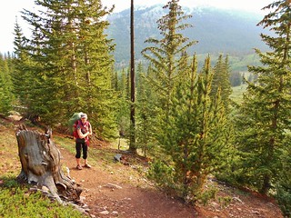
We arrive at the trailhead fairly late in the day and start hiking. About 15 minutes into our hike, it starts to sprinkle. We pull out the tent fly, drape it over both of us, and continue hiking! It took us awhile to coordinate hiking while sharing this canopy, but eventually we got the hang of it.
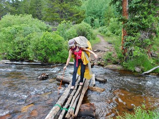
Along the way, there are several creek crossings. They are bridged in various manners and generally rather easy on a backpacker. As the sun got lower on the horizon, it started cooling off. Even with the rain, we enjoyed the hike as it is absolutely beautiful. It was hard to believe we were in the Mt. Evans wilderness! We were almost entirely alone!
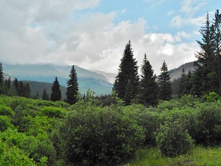
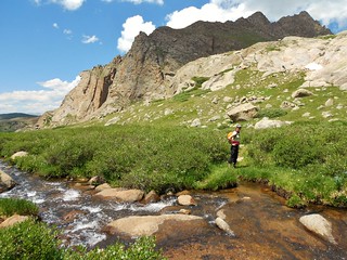
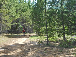
After an hour of hiking, we had travelled about a mile. We were rewarded with this gorgeous view!

My picture does not do this grove justice. Aspens with wild roses blanketing the forest floor. We swooned at nature’s romance before us! I was looking for Queen Titania, Puck, and the rest of the Midsummer’s Night’s Dream ensemble!
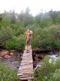
Another Creek Crossing
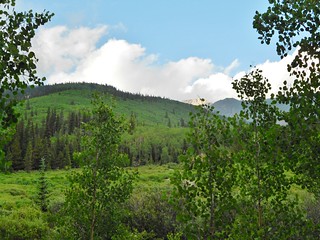
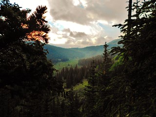
It’s now 7pm. After 2 hours, we have travelled 4 miles and are starting to see the mountains, through the afternoon clouds. From this spot, we still have 3 more miles to get to Helm’s Lake, or another 5 to get to Abyss Lake.

Erin, about 2 miles from Helm’s Lake.
Intersections were marked well, but sometimes it was confusing.
Switchbacks just below Helm’s Lake. From here, it took us another 40 minutes to get to our campsite.
Thanks to Erin, for pointing out this amazing sunset!
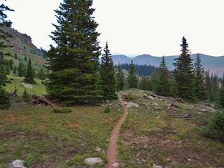
The Trail, just before we encounter groves of Willows, which surround Helm’s Lake.
Around Helm’s Lake, the trail exists in sporadic spurts, so there is a bit of route finding involved. By the time we got to Helm’s Lake, it was 8:15pm and I was exhausted.
It had been a long day; unpacking from a recent business trip to Seattle and repacking for this backpack trip! Being at sea level all week made the hike a harder than it should have been and the 7.4 miles of hiking with overnight packs had definitely worn me out.
Rather than fight with the willows in the dark, for 2 more hours up to Abyss Lake, I decided it was best for me to camp at Helm’s Lake. This way, we could get to sleep early and be prepared for the long day tomorrow.
We found a perfect little camping spot, underneath a pine tree and next to a large boulder. We unpacked our bags and set up camp. Erin filtered some water while I worked on the tent. By now, we definitely have the whole camping system down.
It was a humid night, from all the rain, so I had no problems with my sinus cavity. We got into bed early. There were some bunny rabbits, or something running around outside, which woke me up a few times. But, it was still a nice night out, if just a bit on the warm side.
We woke up at oh dark thirty. As always, Erin was moving first. I was not feeling all that well and woke up with a headache. Darn it, being at sea level all week had messed up my mojo!
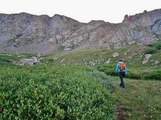
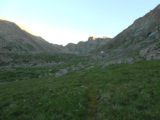
Erin hiking through the willows. After 45 minutes of hiking, we were about 1 mile from Abyss Lake. Taken at 6am, we were both hiking along at quite the clip-hoping to get to the Sawtooth with enough time in the day before the thunderstorms.
We heard some obnoxious hooting and hollering at about 6:45am. We supposed somebody had summited Bierstadt-maybe it was their first 14’er. Who knows; we just thought it was ridiculous the amount of noise they made!
The Sawtooth at First Light!
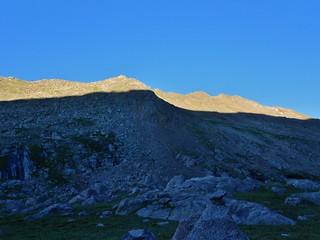
The South Ridge of Bierstadt; for the intrepid hiker!
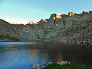
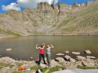
Abyss Lake and the Sawtooth at 7am.
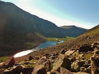
Abyss Lake, from around 13,300 ft on the Northeast Slope of Bierstadt. It took us about an hour to get around the lake (on the more northish side) and then 30 minutes to get to this spot.
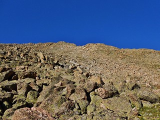
Looking up to the summit of Bierstadt from the same spot as the picture before.
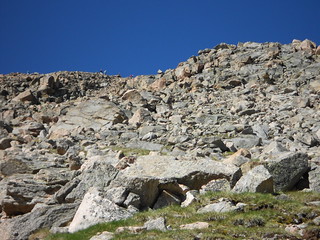
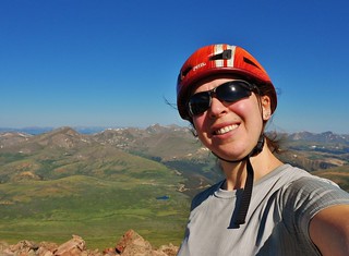
Taken at 8:45am. Those people are near the summit, about 500 feet away from me. By the time I get there, I am sharing the top with 80 people! It’s a totally crazy scene, with kids and dogs and a seal balancing a rubber ball on it’s nose.
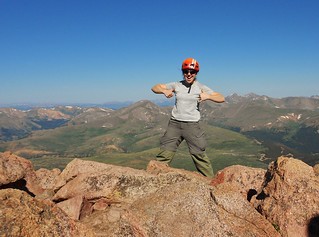
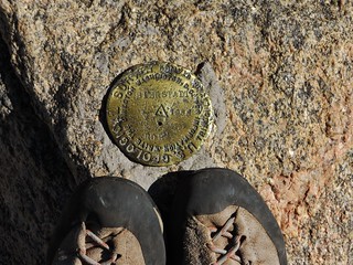
Yay! Summit! At 9:15am with about 80 other people!
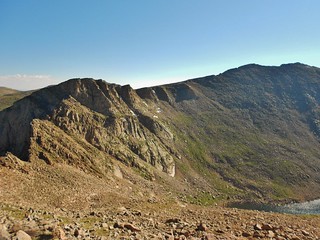
When I start descending from the summit of Bierstadt, I take this picture of the Sawtooth and Mt. Evans.
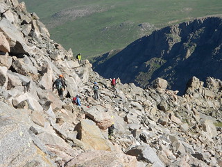
Hoards of scramblers heading towards the Sawtooth.
By the time I reach Erin, who is napping at 13,300 ft, there is an almost steady stream of people scrambling across the Sawtooth. I still have a headache; it has not gone away all morning. Considering that we have to pack up our stuff and take a long hike out, I’m really not feeling up for the Sawtooth.
The crowds also make me nervous. I have seen some pretty novice style hikers heading over there…and I don’t feel like rescuing anybody today. If I do the Sawtooth, in the future, I’m going to plan on a Wednesday morning!
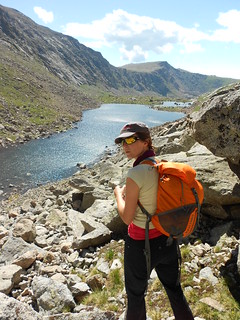
Erin on the way back down to Abyss Lake
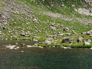
On the way back to camp, we go around the south side of Abyss Lake. It took about the same amount of time to get around, but it was fun to go a different way. Erin wants to hop rocks across an inlet, so I get this rad picture of her doing it!
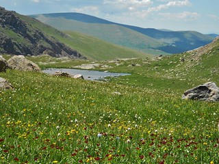
A pretty pond, below Abyss Lake. The wildflowers were plentiful in this area.
Stream crossings and navigating willows is a lot easier in daylight with day packs on, than at night with heavy packs!
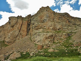
Erin’s Project is the large diagonal chimney on the left side of this wall. I also spy some options on the main face…
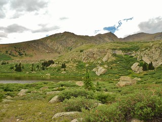
Helm’s Lake from near our tent! Isn’t it pretty!
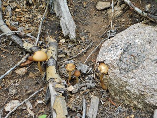
There were lots of wild mushrooms in the area.
Erin waiting for me on the hike out.
I was suffering from dehydration and maybe even a bit of heat exhaustion. It was really warm outside and I was not feeling well. As a result, I was hiking pretty slow. I had also acquired a large blister on my right heel a few days before our trip and it was smarting something fierce during the whole hike.
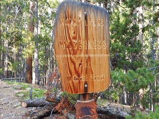
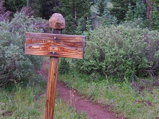
I was really happy when I saw this sign, as it meant that I was almost back at the trailhead.
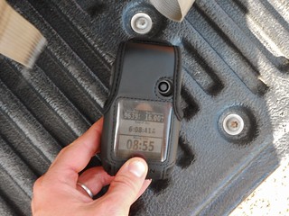
GPS from the hike…not including the 7.4 miles hike up to Helm’s Lake!
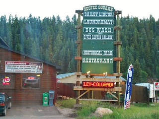
In Bailey, we stop at the Rustic Bar for libations and dinner. They were super nice to us. There was live music, too!

We saw an incredible thunderhead develop as we descended into Denver.
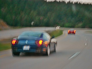
Icing on the cake; we see two gorgeous Ferrari’s driving by. We manage to keep them in our sights all the way to Morrison…awesome!
Tags: 14er, Abyss Lake, Backpacking, Hiking, Mountaineering, Mt. Bierstadt