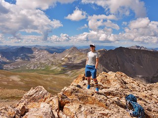
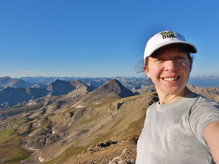
Climbergirl in the middle of her Sufferfest
Doug at the end of his Sufferfest
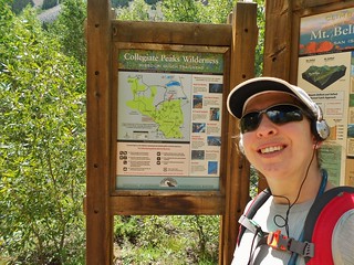
On Saturday, Doug and I decided to tackle a conglomerate of mountains in the Sawatch range. There happen to be 5 co-located mountains, which are all centennials (among the top 100 highest peaks in Colorado). Many people hike 2 of them in a day, fewer will do 3 in a day, and even fewer will do 4 or more. Since Doug and I are both training for ultras, we set out to do all 5 in a day.
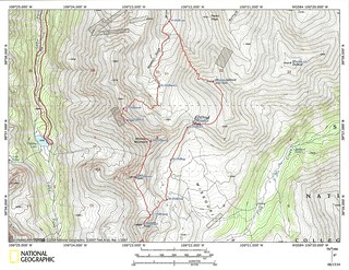
My game plan was to do the loop and return to the Missouri Trailhead. At the end of the loop, Doug would drop off the side of Oxford and connect with the Colorado Trail, run for an additional 8 miles, and head back to the road. I would drive the truck from Missouri TH to the CO TH and pick him up, saving him a 5 mile gravel road run at the end of the day.
If everything worked out right, I wouldn’t have to wait for him and we’d both have a great day of training.
We left the Missouri Gulch Trailhead at ~4:30am. It was cold outside; I could see my breath. After 10 minutes of warm-up, Doug took off at a faster pace. He had a lot further to go, than me! In complete darkness, we ascended the gulch. At the stream crossing, it was a little confusing and I spent about 5 minutes staring at the babbling brook wondering which way to go…but, then I saw a footprint in the mud on the opposite side. Disco!
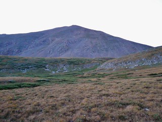
Looking South towards Missouri Mountain
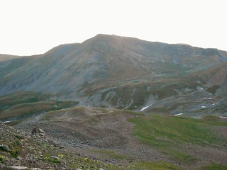
The Side of Belford.
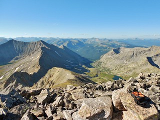
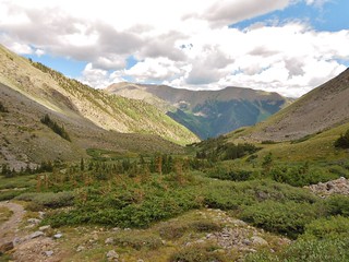
At 6:20am, there was finally enough light for me to take a picture. I took these 2 pictures (above), from 12,300 ft in the upper basin, below Missouri Mountain and Mount Belford.
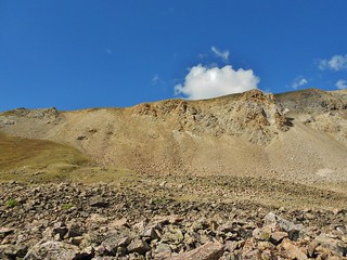
At 12,600 ft, there is a sign on the trail which points the way towards Missouri Mountain (or Elkhead Pass if you’re headed that way!). It would be really hard to miss this sign as it’s on a post and there is nothing around it.
When I got to the sign, I looked up the side of Missouri Mountain and I could see Doug attacking the trail. He was about 40 minutes ahead of me.
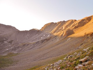
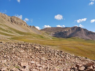
From the sign, I hiked for 30 minutes, up the side of Missouri Mountain and then took this picture of Mount Belford.
Taken from the same spot as the picture above, just looking towards the West Ridge of Missouri and Elkhead Pass. I love the early morning Alpenglow!
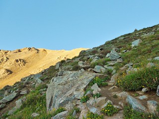
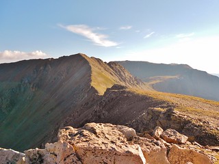
Taken from the same spot as the last two pictures, just looking at the nice trail ahead! I only have a couple hundred feet of gain to get to the North Ridge of Missouri Mountain. For a moment, I see Doug waving from the ridgeline and then he disappears!
Finally, about 3 hours after leaving Missouri Gulch Trailhead, I reach the summit of Missouri Mountain! First summit of the day; at 7:20am! The peak to the left of my head is Emerald Peak, which I will heading towards after I climb Iowa Peak (behind my head!)
When I leave Missouri Mountain, I hear from Doug that he’s at the saddle of Iowa and heading up. I race down Missouri, so I don’t widen the gap!
Thirty minutes later, I’m on the summit of Iowa Peak…In this shot, I’m looking at Emerald Peak (my next objective!). I hear from Doug that he’s climbing Emerald and that it would be easier/faster to go at it from the left rather than straight up. Nice beta!
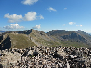
From the summit of Iowa Peak, here’s Missouri Mountain (I was just on the summit 30 minutes ago!). Missouri Mountain was a lot of fun. Running the ridge on the top was like a dream…the path is clear of rock debris and the view is amazing.
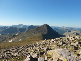
View looking north from summit of Emerald Peak. Here you can see Iowa Peak, Missouri Mountain, Belford, and Oxford!
From the summit of Iowa Peak, it took me 50 minutes to get to the summit of Emerald Peak. I ran into Doug on the way over to Emerald and we chatted for less than a minute. He confirmed again the best choice of routes up Emerald and he was off to Elkhead pass (which can be seen in the picture above)!
Taken from the top of Emerald Peak, a view into North Texas Creek Basin. It looks really pretty in this area. The left of the twin peaks is a bi-centennial (It is Pt 13762, which is number 121 in the state!).
Dropping off of Emerald, one ends up on the south side of Elkhead Pass. In order to access Mounts Belford and Oxford, one would then need to ascend Elkhead Pass…so that’s where I head next. In the picture, you can see the pass. It’s the saddle between the West Ridge of Missouri Mountain and Mount Belford.
From where I am in the picture above, there is a lake directly in front of me, at 12,717 ft. Here, I used a feeder stream to filter water for the rest of my run.
Taken from the same spot as the last picture, just looking at my descent. The way I came down was from the right of the small nipple on the skyline. There was a nice boot skiing scree trail leading down from this spot.
Roughly 2 hours from the summit of Emerald Peak, I was on the summit of Mount Belford. It was 11:15am. When I arrived, Doug was already dropping off the summit of Oxford; being about an hour in front of me.
With the collection of clouds growing, and knowing that I needed to have time to return to the truck and drive to the CO trail, I decided to forego Mount Oxford. Besides, I think it would make a really nice training run, for some future adventure when I didn’t feel rushed!
Time to head down! Rather than heading back to Elkhead Pass, I went down the traditional North side of Mount Belford (with it’s myriad of switchbacks).
45 minutes later, and 2,200 ft lower, and I was off Mount Belford…this is looking up the north side descent route! With over half of my elevation loss happening in less than a mile, I was now psyched to be on more level terrain.
As I jogged down the trail, I passed a group of Boy Scouts heading up. I gave them some encouragement and they returned the favor. I was surprised there were people still climbing towards the summit; with so much gain left at so late in the day!
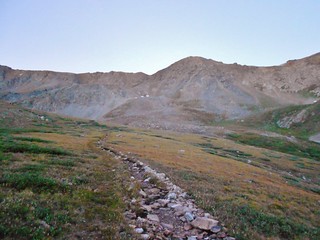
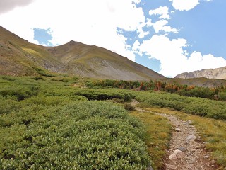
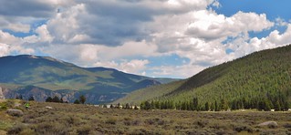
The trail going down Missouri Gulch.
Back at the Trailhead…I clocked 14.5 miles with 6,600 ft of gain. It took me ~8 hours total, including rest stops on the top of all 4 mountains and one for filtering.
Now that I was finished with my Sufferfest; it was time to support Doug at the end of his! I took off all my running gear and changed into sandals and a fresh outfit. It felt so nice to air out the toes!
I drove his truck down to the Colorado Trail and waited for him. We had agreed to radio each other at a certain time, so when the time came, I gave him a shout out.
“Earth to Doug, Earth to Doug, I’m at the CO Trail. Over!”, I said.
A couple seconds later, I hear, “Oh $hit, just a minute!” Some rustling noises and some scratching sounds could be heard in the background. Then, “You scared the crap out of me. I can’t talk now, I ran into a heard of Elk and there is a Male ramming his head against a tree right in front of me!”.
I reply with, “Did you get a picture of it with your phone?”.
“No way, I’m just trying to figure out how to get around them without getting attacked. I gotta go, I’ll call you later when I’m safe”.
So, now, I’m sitting in his truck at the trailhead. I’ve never been down this trail, I don’t have a map, and I don’t have a method of defense other than my trekking poles. I pray that he makes it okay and wait nervously for him to call back. My legs are starting to get stiff from the after effect of my sufferfest, so I get out and stretch.
While I was outside stretching, Doug tried calling me (unbeknownst to me). I didn’t want to radio him, in the event he was still surrounded by the heard, so I had left the radio momentarily in the car. By the time I was done stretching, he had given up the attempt. Darn!
So, finally after 20 minutes of waiting, off in the distance, I see a guy walking down the road. Funny, he’s not on trail! OMG, it’s Doug! I felt bad that I had left the radio in the car; but he’s in good humor about it being the end of his sufferfest…so no worries!
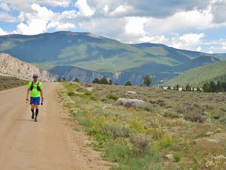
The view of Doug running towards the Colorado Trailhead (from alongside the gravel road). He had to take a massive detour to get around the elk heard.
Tags: 13'er, 14er, Centennial, Emerald Peak, Iowa Peak, Missouri Mountain, Mount Belford, Mountaineering, Sawatch Mountains, Trail Running