On Saturday, Crystal, Jen, Duke the dog, and I piled into the Subaru. Our destination was Huron Peak. Our plan was to car camp at the trail head on Saturday night. Starting at oh-dark-thirty would give us the best chance to make the summit.
According to Mr. Dziezynski, “Huron is a classic climb on a picture-perfect mountain! This 14er may be the most beautiful hike in the Sawatch Range, with excellent views from the summit pyramid.”
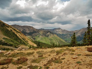
It is for this exact reason, I selected Huron Peak as our destination. If successful, it would be Crystal’s first 14er, so I wanted her to be rewarded with excellent views. Also, Jen and her doggy Duke were there with us, so I wanted to pick a mountain with a clean, easy to navigate trail.
Starting in the dark, I wondered if the weather would comply…I dearly hoped so!
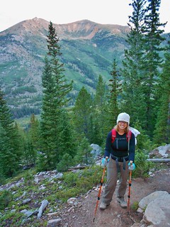
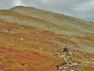
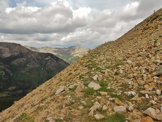
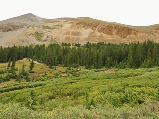
The standard route up Huron is really nice. The trail is in excellent condition. Here, we’ve been hiking for 1 hour 15 minutes and it’s just starting to get light outside.
Crystal taking a breather.
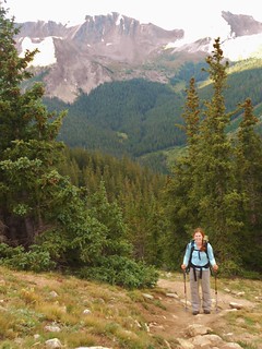
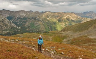
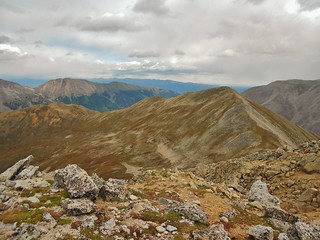
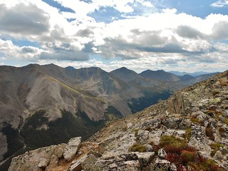
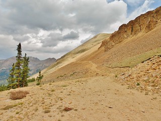
Jen making it look easy. The Apostles stand proudly in the distance.
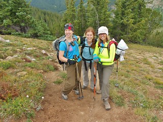
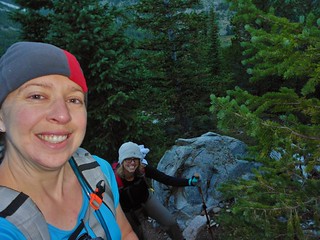
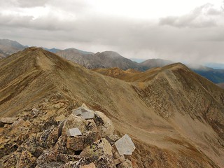
Here we are having fun hiking up Huron Peak!
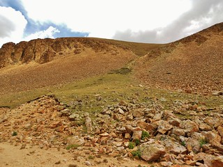
At 12,270 ft, there is a big meadow. We stop to take a short break. It took us 2 hours and 20 minutes to get here, from the car (near 2wd pullout). The wind starts to pick up and proceeds to blow at a fairly consistent 20-30mph rate.
Somehow, I’ve forgotten to bring my mittens and Crystal’s light liners aren’t adequate. So, I pull out some plastic sandwich baggies and we use these as make-shift hand coverings. At least our fingers aren’t going numb anymore!
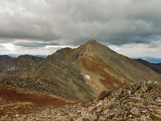
Here’s Jen approaching the final summit pyramid, at 13,000 ft. Jen got stronger as we hiked higher, awesome! The storm clouds were definitely brewing; and the wind picked up. It was now blowing up to 60 mph…so sometimes we had to brace ourselves for the gusts.
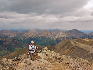
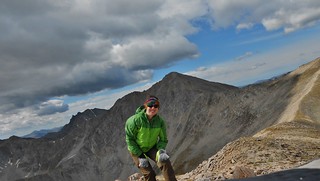
Crystal approaching the summit. I was so psyched for her to get her first 14er! It was not an easy one, considering the wind and the persistent coldness.
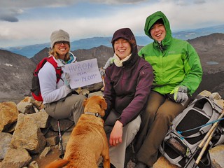
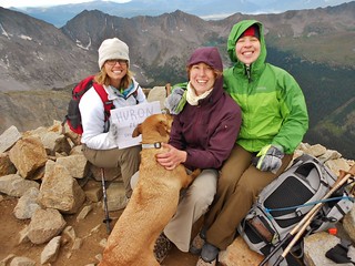
Exactly 4 hours after we left the car, near the 2wd parking, we were on the summit of Huron Peak! The views were amazing, so Mr. Dziezynski was not lying! Now, it was just a question of a dry descent…would we have one?
The gals opted to go back the same way that we came up, but I wanted an extra challenge. So, I decided to go down the north ridge and bag a tri-centennial, Pt 13462, en route. With the weather looking iffy, I better go fast. Time to jog!
20 minutes later, here I am on unranked Pt 13,518. That’s Huron Peak behind me.
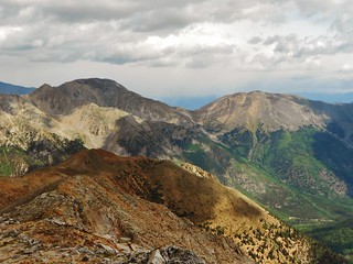
Taken from the same spot as the last picture, just looking north towards unranked Brown’s Peak (next objective!).
Looking back at Huron…where I was 40 minutes ago! It took me 20 minutes to get from Pt 13,518 to Brown’s Peak. I wanted to go faster, but the talus was fairly big and unstable, so I had to be careful.
Taken from the same spot as the last picture, just looking north to Pt 13,452. It is a tri-centennial peak, being ranked #280 highest mountain in Colorado.
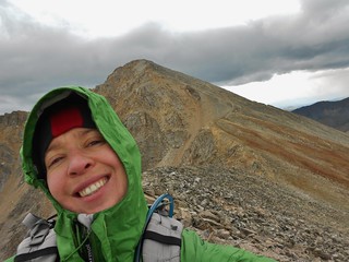
Selfie on the Tri-centennial Pt 13,452 with Huron Peak in the background. I was psyched it was not raining on me! In fact, the sun came out and for the first time all day, I felt warm. Ahhhhh. My thoughts were with Jen and Crystal; as I hoped their descent was going well.
From the summit of Pt 13,452, here’s a shot looking East towards Missouri, Iowa, and Emerald. Good times!
From the summit of Pt 13,452, here’s a shot looking North at Mt. Hope and Quail Mountain!
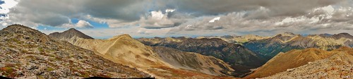
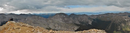
Pt 13,452, Huron Peak, and Brown’s Peak. I love this panorama!
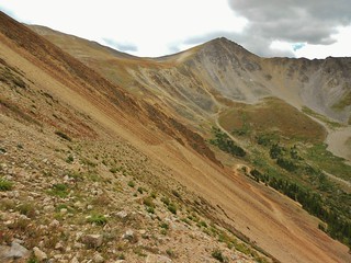
Rather than cut straight down into Lulu Gulch, I traversed over to Pt 12,672 and then descended the 4WD trail. The picture above was taken of Brown’s Peak, from the top of the 4wd road.
The 4wd road is almost completely gone and in places, there is just a small path through the rubble which cuts through the steep slope. The slope is really steep, so going straight down would be awful…if there was snow, I would have glissaded this part!
If I came down again, I think it’d be more efficient to just cut down to Lulu Gulch from the south side of Middle Mountain, rather than do the traverse to the road. In this picture, you can see how the 4wd road is almost completely wiped out…
I would come down where this green gully emerges from the south side of Middle Mountain!
Taken from the same spot as the last picture, just looking West into Lulu Gulch! Happy to be back in Tree line!
From the upper part of Lulu Gulch, looking back at the awful 4wd road used for a descent.
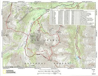
This is my topo map with waypoints. I went up the standard route to the summit of Huron. I descended the north ridge and bagged the 13ers thereon. Again, the way that is highlighted in the map, for a descent on the south side of Middle Mountain, is the best! It’s not going to save any time to descend via the 4wd road from the summit of Pt 12,672…since the road is pretty much covered in boulders.
All in all, my gps device said I had covered 11.9 miles. I started at 5:30am and finished at 12:40pm. I probably had close to 4,000 ft of gain, since I came down the north ridge route. I did a little bit of jogging coming down the north ridge, but it was not as runnable as, say, the north ridge of Missouri. The rocks were ankle breaker sized, or larger, and were loose.
Tags: 13'er, 14er, Brown's Peak, Hiking, Huron Peak, Pt 13452, Sawatch Mountains, Tri-centennial