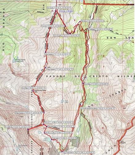
Our loop hike on California Peak!
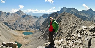
Clare on the summit of Bicentennial Pt 13,660
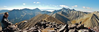
Frank on the summit of California Peak
After having to cancel my CMC trip for Mt. Meeker, due to heinous weather, I was left with a blank slate weekend.
What should I do? So many mountains to climb…how do I decide?
At the height of my mountain frenzy, I get an email from Frank and he suggests California Peak. Neither of us have done it, he’s been to the area and is willing to drive, we can car camp and don’t have to get up early, it’s…Perfect!
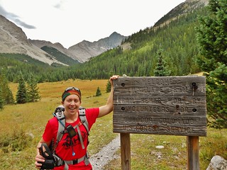
As we pulled into a perfect car camping spot, near the Lower Huerfano Trail head, a layer of fog settled into the valley. It reminded me of Seattle; damp and cold. We scouted out the trail head as the last bit of sunlight disappeared. I was looking forward to crawling into my warm sleeping bag. I downed the last of my tea and said good night to Frank.
Seven hours later, it was wake-up time. We planned to leave the trailhead at 6am…except we let that slide till 6:15am. There was no rush as the fog had deposited a fresh layer of dew on the ground. As we hiked, the fog lifted and when we were approaching tree-line, the sunshine was glorious!

About 50 minutes into our hike, we came upon this beautiful meadow. The trail is eaten up by this meadow, so it’s not obvious where the route goes. Since I had GPS and a map, we were fine…but if you just aim to the right of the gravel pile at the far end of the meadow, you’ll be fine!

We followed the trail as it starts to climb to the long ridge of California. About 1 hour 30 minutes into our hike, we turned around for this amazing view!
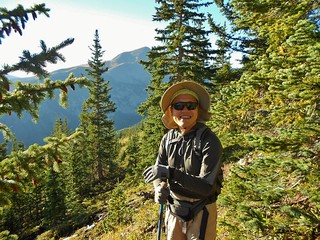
Here’s Frank enjoying the beautiful day.

We finally gain the North Ridge of California Peak after hiking for 1 hour 45 minutes! The wind picked up; it was sustained at probably around 30 mph.
We hike for 50 minutes on the north ridge of California Peak, when we are greeted by the side of Pt 13250. There are tons of false summits on this ridge, so we try not to get our hopes up!
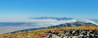
From near the top of Pt 13250, I turn around and get this rad panorama shot of the fog over the sand dunes and the Crestone Peaks!
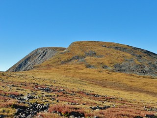
Our next hurdle, Pt 13476. We have now been hiking for 3 hours, from the Lower Huerfano TH.

Finally, we can see California Peak…it’s tucked behind two other sub peaks! Out to the left are Blanca and Ellingwood Peaks.
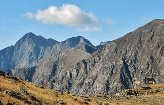
When we descended Pt. 13,476, we saw a herd of mountain goats!

Finally, after 5 hours of hiking, we reach the summit of California Peak!
The weather was fabulous, so we decided to go for the Bicentennial (Pt 13,660) and the Tri-centennial (Pt 13,577). In order to do this, we continue over California Peak, dropping down the South ridge.

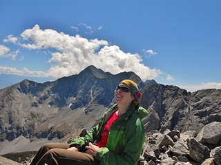
In this picture of Frank and I, on the summit of California Peak, the Tri and Bi are behind us (but in front of Blanca, Ellingwood, and Little Bear Peaks).

A Panorama from the South Side of California Peak. On the left are Huerfano and Lindsey. To the right, but in the background are the Blanca, Ellingwood, and Little Bear Peaks. In the foreground are the Bi and Tri-centennial, which are our next destination!

The South Side of California. I’m glad we did not go up this way…it was nice going down this!
Taken from the same spot as the last picture…just looking East…that’s Huerfano Peak and Mt. Lindsey. Sparkling down below is Lost Lake!

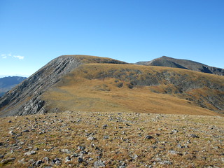
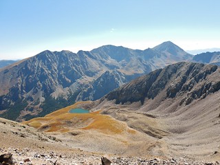
Pt. 13,660, Unranked 13er, California Peak, Unranked 13er, and Pt 13,557. This was taken from the Southeast ridge of Pt 13660. On the far right is Pt 13557, which is the tri-centennial we will have to climb over, in order to get back into the Huerfano Valley.
From this spot, there was quite a bit of scrambling to climb Pt 13,660. We had fun on this ridge climb.

Here I am on Pt 13,660.

Frank enjoying the view and his snack!

On the way down Pt 13,660, I got a fantastic foot dangle off it’s west ridge!
Finally, we’re on the summit of Pt 13577! I’m ready to descend to Lily Lake and the warmth of the Huerfano Valley. It took us 6.5 hours to get to this spot, after leaving from the Lower Huerfano Trail Head.

I note that my friend Helen, from Basalt, has signed the register merely one week before me!

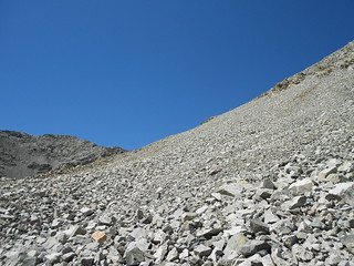
After 20 minutes of descent from Pt 13577, I turned around to get this picture. It was really steep, but surprisingly solid boulders.

Taken from the same spot as the last picture, just looking at the side of the mountain, so you can see what I mean by really steep! Frank is standing at the lower right of frame, taking a short break.

Lily Lake sparkles way down below!
It has been almost an hour since I was on top of Pt 13577 and I’m still descending to Lily Lake! Looking back up, it seems crazy I came down that slope…but I did!

Finally, we made it to Lily Lake!!! Now, we just have a few miles of beautiful mellow trail hiking to get back to the car.
About 45 minutes from the car, in the Upper Huerfano valley. We’ve been hiking for about 9 hours now. The Huerfano Valley is so pretty, it’s easy to ignore the pain in my feet from the hike! I can’t wait to come back here to climb Huerfano, the Iron Nipple, and Mt. Lindsey. Maybe next summer!
Tags: 13'er, Bicentennial, Centennial, CO, Hiking, Huerfano Trail Head, Mountaineering, Sangre De Cristo, Tri-centennial