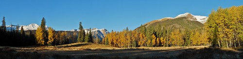
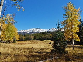
Lovely Fall Day in the San Juans!
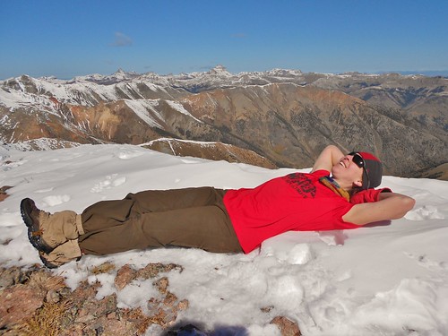
Time for a rest on the summit of Pt 13,811!
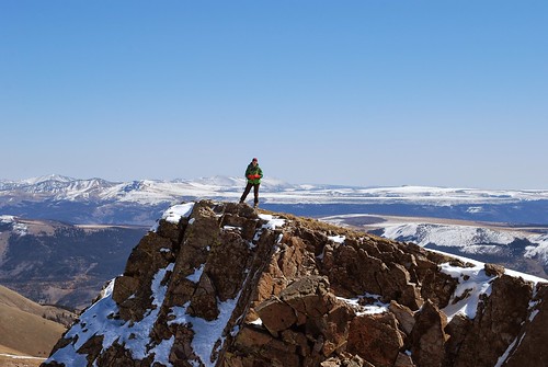
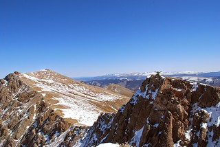
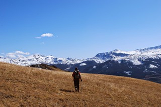
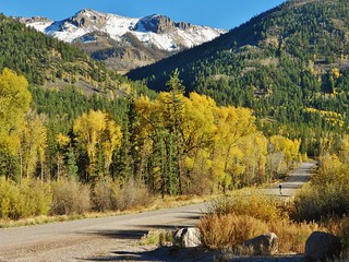
On my way to Pt 13,832 (Thanks to Frank for such an awesome picture!)
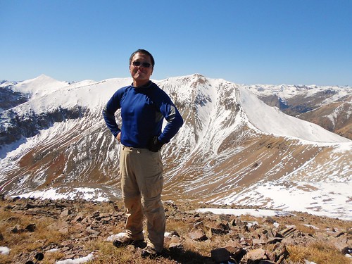
Frank standing proud on Pt 13,832.
Our Route!
After my 20+ mile run, I took a rest day with Dennis in Leadville. We enjoyed a leisurely morning and used the dry sauna at the hotel. Then, we went to the Museum of Mining. Dennis used to work for MSHA and I really enjoy geology, so it was pretty fun.
Later in the day, we met up with Frank in Buena Vista. I hopped in Frank’s car and Dennis headed home. Frank and I then drove to the San Juans to join the 14ers Fall Gathering. We were excited to meet some other mountain enthusiasts and our goal was to climb “The Points” which are two centennial 13ers just outside of Lake City.
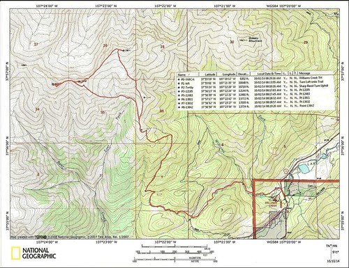
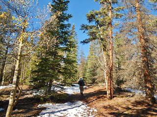
We left the Williams Creek Trailhead in the darkness. The path was fairly straightforward, with exception of one slightly tricky creek crossing. In daylight, it’s totally obvious, but at night, it was a little hard to see the trail on the other side of the creek.
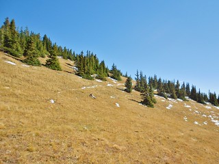
Finally, after 1.5 hours of really super cold hiking, the sun came out! We were both saddened a little that we missed the height of the fall colors, but it was still really pretty.
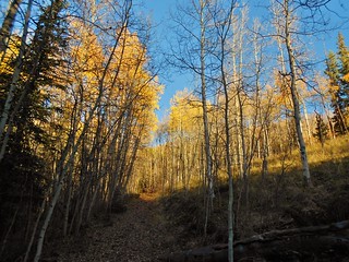
Here’s Frank crossing one of the frozen meadows.
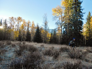
Eventually, the trail merges with an old jeep road, which is lined with beautiful aspens!
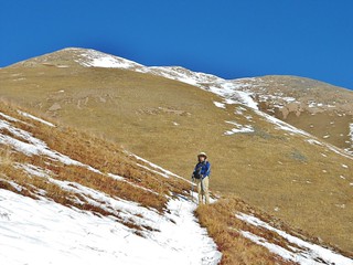
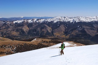
~3 hours into our hike, the road steepens as it climbs to Pt 12,195.
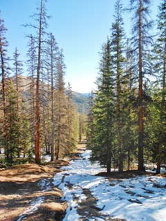
Looking back down the steep, old jeep snow covered road.
![]()
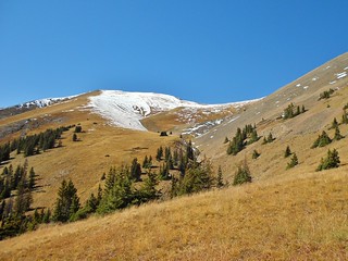
~3 hours and 20 minutes into our hike, we get to Pt 12,195. There is an amazing view of the San Juan mountains. We can see Redcloud, Sunshine, and the Points on the horizon!
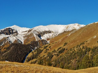
Close up of Sunshine and Redcloud, two San Juan 14ers.
Looking to the north, I can see our destination, the Points!
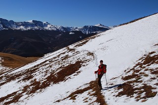
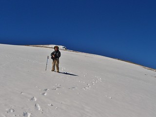
On our way up 13,811 I stopped to catch my breath. Frank got this excellent shot of me crossing a patch of snow.
Here’s a picture of Frank, that I took while I was taking that break!
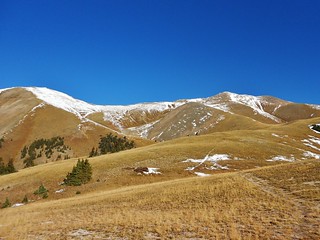
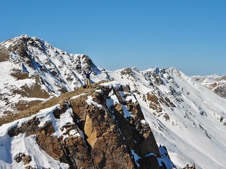
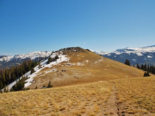
Pt 13,811 is hidden behind the bumps on the horizon, so unfortunately you can’t see the summit. We followed Mr. Roach’s directions on our summit of Pt. 13,811 and I used my Garmin on occasion to make sure we were on target. We climbed straight up, on grassy and rock strewn tundra, to the right of a deeply inset gully. When we got to the top of the ridge, we were just a hare west of the summit.
Here’s Frank as he’s traversing East to the proper summit of Pt 13,811.
Lots of footprints in the snow, from the 14ers Fall Gathering participants, who climbed the points on the day prior!
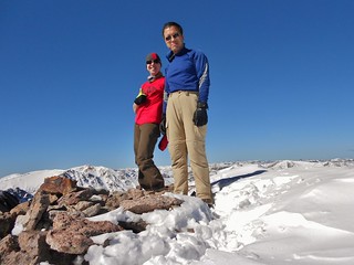
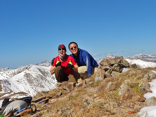
Here we are on the summit of Pt 13,811. It took us 5 hours from the Williams Creek Trailhead. We took several long breaks on our hike and definitely were enjoying the sights! I love the San Juans, and in Fall, it’s spectacular.
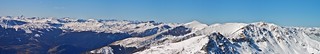
View looking West, from the summit of Pt. 13,811. Wow!
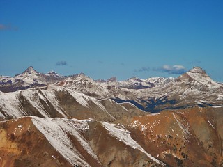
View looking North, from the summit of Pt. 13,811. That’s Wetterhorn, Matterhorn, and Uncompahgre.
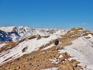
Now, we had a bit of a haul, with about a mile of traversing, to get to Pt. 13,832. On the way over there, we had to go over a few little bumps on the ridge as well as Pt 13,632. It was a gorgeous day, with just a steady breeze, so we were able to make good time.
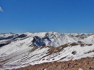
Looking back at Pt 13,811 from Pt 13632. Taken by Frank.
Frank on Pt 13632, with Pt 13832 behind him.
On the summit of Pt 13832. Now, we just have 6-7 miles to get back to the car!
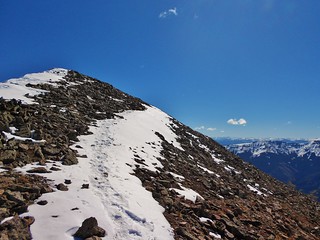
After the summit of the 2nd point, Pt 13,832, we traversed back over to Pt 13632 and then descended a really nice, not-to-steep snow slope. There was some boot skiing involved and plunge stepping. It was a very nice descent!
Here’s Frank, looking upslope, behind me!
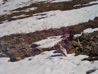
We saw a Ptarmigan, as it transitioned to winter feathers!
At this point, we had been hiking for 8 hours, so I was starting to feel hungry for lunch! We made a deal to take a break once we hit the trail down by Pt 12,195.
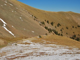
At the bottom of the gentle snow slope, the snow ran out and there was a gully.
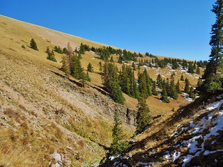
Here is the gully we crossed. It was a little tricky, but we figured it out with just a couple of really simple class 3 moves. From here, we cut across the sandy slope to get back on trail. You can just barely see the snow filled trail, which is diagonally ascending the hill, through the trees.
Close up of the snow filled trail!
Looking back at our descent from the trail. You can see the curving snow field we descended and then the rounded grassy ramp which ends in the gully.
Frank got this picture of me, making a bee-line for Pt 12,195 and the trail (which is in front of us!).
Heading back to Pt 12,195. From this same spot, in the morning, it took us 6 hours to climb all the points and make a loop. Now, we only have a couple hours left, to get back to the trailhead!
Now that it’s 10 hours later, there is no more frost in the meadow! From here, it took us one more hour to get back to the William Creek Trailhead. Long day!
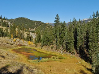
We passed this colorful beaver pond, which we missed earlier due to hiking in the dark!
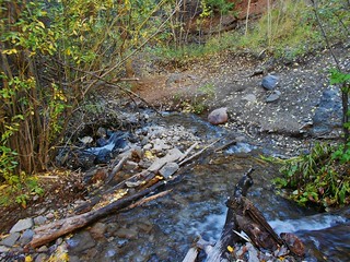
The 2nd Creek Crossing. It took about 10 minutes for us to reach the 1st one, after crossing this one.

The 1st Creek Crossing. In the fall, this was just a little trickle! Now, we’re getting really close to the trail head and I’m getting excited for dinner!
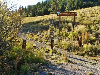
Yay! The Williams Creek Trail Head has room for 5-6 cars. But, we camped a little ways away (to be away from the road. From this spot, it took us 11 hours to hike the Points. It was 15.8 miles total, the way that we went.
Here’s Frank walking towards the Williams Creek Campground (where we parked and camped).
Tags: 13'er, 14ers Fall Gathering, Centennial, CO, Pt 13811, Pt 13832, San Juan Mountains, Williams Creek Trailhead