Posts Tagged ‘San Juan Mountains’

Mountaineering – Pt 13,811 and Pt 13,832 – San Juan Mountains, CO

Sunday, October 5th, 2014

Panorama From Williams Creek Trail
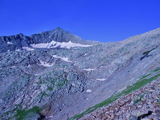
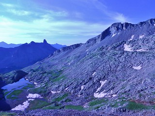
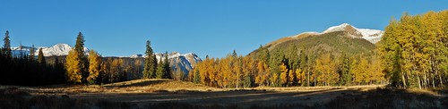
Lovely Fall Day in the San Juans!

Napping on Pt 13811
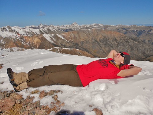
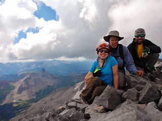
Time for a rest on the summit of Pt 13,811!

Clare in the San Juan Mountains
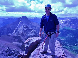
On my way to Pt 13,832 (Thanks to Frank for such an awesome picture!)

Frank on Pt 13832
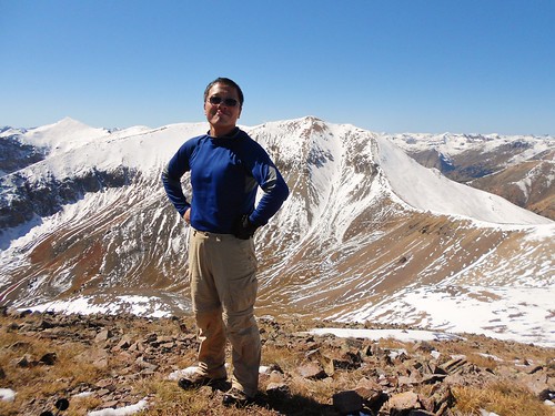
Frank standing proud on Pt 13,832.
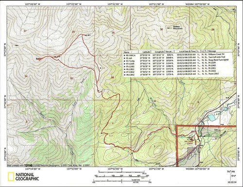
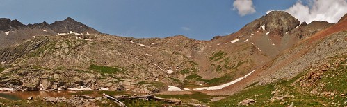
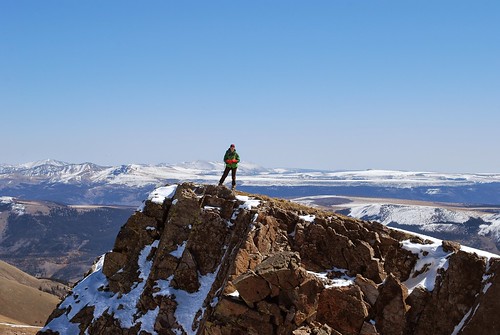
Pt 13811 and 13832 Topo Map with Waypoints
Our Route!

After my 20+ mile run, I took a rest day with Dennis in Leadville. We enjoyed a leisurely morning and used the dry sauna at the hotel. Then, we went to the Museum of Mining. Dennis used to work for MSHA and I really enjoy geology, so it was pretty fun.

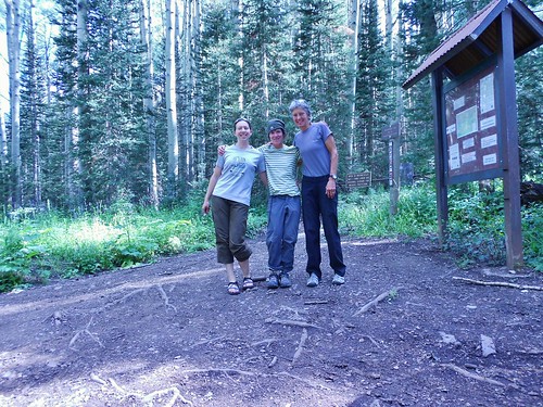
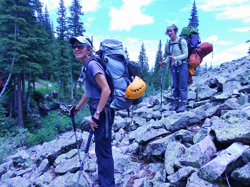
Later in the day, we met up with Frank in Buena Vista. I hopped in Frank’s car and Dennis headed home. Frank and I then drove to the San Juans to join the 14ers Fall Gathering. We were excited to meet some other mountain enthusiasts and our goal was to climb “The Points” which are two centennial 13ers just outside of Lake City. (more…)

Mountaineering – Wilson Peak (14,017 ft)

Sunday, August 3rd, 2014

Success on Wilson Peak
Clare, Mark, and Seth on the summit of Wilson Peak

Clare Scrambling on Wilson to Gladstone Ridge
Scrambling on the North Ridge of Wilson Peak. Gladstone and Mt. Wilson are behind me.

After climbing Dallas Peak, Seth, Mark, and I were hungry for more rock scrambling. There are so many mountains in the San Juan Range, one could spend hours deliberating…

However, having done Gladstone less than a week prior, and spending a couple days staring at Wilson Peak from the south side, I proposed we do Wilson Peak. Lucky for me, the guys were on board!

Strategically, by bagging Wilson Peak now, the next time I was in the area I could focus on El Diente and Mt. Wilson without having to cram all three peaks into one long weekend.

(more…)

Mountaineering – Gladstone Peak (13,913 ft)

Saturday, July 26th, 2014

Gladstone Peak from Base of Wilson Peak
Gladstone Peak taunting us as we stand near the base of Wilson Peak.

Upper Bilk Basin Lake at 12,060 ft
The Unnamed Lake at 12,060 ft and the view of Lizards Head

After a serene evening in Upper Bilk Basin, we awoke to sky full of stars. It was a good sign. Who knows, maybe it would be a clear day. I thought we had a really good chance for the summit, since we were only a couple miles away.

We arrived at the unnamed lake, at 12,060 ft at 6am. The lighting was flat and so the view of Gladstone and Wilson Peak was fuzzy. We headed up to the obvious saddle between Gladstone and Wilson Peak, getting suckered by some cairns.

Then, as we neared the base of Wilson, we realized we were too far from Gladstone. We were hoping to hit the ridge only 0.5 miles from the summit of Gladstone…and now we were about a mile away!

Oh no! My heart sunk. We had wasted quite a bit of time. We looked at the long ridge separating us from our destination and it just looked icky. Rather than take a chance traversing the entire ridge, we descended back to the lake to try again. Maybe in the brightness of full sun, we’d see the proper route.

Gladstone and Wilson Peaks from Lake at 12,060 ft
Panorama taken from the Lake, showing Gladstone Peak on the left and Wilson Peak on the right!

(more…)

Mountaineering – Backpack Into Bilk Basin

Saturday, July 26th, 2014

Sunshine Mesa Trailhead - Apres Gladstone Peak
Clare, Meredith, and Helen at the Sunshine Mesa Trailhead

After climbing Teakettle Mountain on Thursday, I found myself in an enviable position. I was in the San Juan Mountains, at the beginning of a weekend, with a reasonable weather window in the near future…Time to climb some more mountains! Giddyup!

Approaching the Bilk Creek Crossing
Lucky for me, Helen and Meredith were thinking the same thing…and before we knew it, the three of us were on our way to Telluride. More specifically, heading to the Sunshine Mesa Trailhead for a backpack into Bilk Basin.

Upper Bilk Basin Camping - Clare's Spot
Would the good weather hold? Would we have the energy, after Teakettle? Would we be thwarted by the treacherous, unsettled chosspile of a mountain that some refer to as Sadstone?

The litany of potential failings raced through my mind as we trundled up Sunshine Mesa road. The road was muddy, steep, and slick. Was this a forbearance of things to come?

(more…)

Mountaineering – Teakettle Mountain (13,819 ft), Ouray, CO

Thursday, July 24th, 2014

Teakettle Mountain from Coffeepot
Teakettle Mountain from Coffeepot. The dark gash in the mountain is the Black Gully!

Clare and Potosi Peak
Climbergirl and Potosi Peak

Ever since climbing Mt. Sneffels, in July of 2013, I had a desire to climb the two centennial 13’ers flanking it. To the west of Sneffels, Dallas Peak stands guard while to the east, there’s Teakettle Mountain. Both captured my imagination and so I must climb them!

Bruce the Champion of Teakettle Mountain
Trip Leader, Bruce, on the summit of Teakettle Mountain

When I saw Bruce’s trip posted on the CMC website, I called him immediately. We had a pleasant conversation and we agreed to meet in a climbing gym, prior to the trip. The last section of Teakettle Mountain involves 5th class climbing; so it’s important people understand rope management, basic knots, safety, and climbing. Them gym meet-up went well, so the trip was on!

Trip Participants: Bruce (Leader), Tom, Frank, Meredith, Lisa, Helen, and I

Our Progress:
Leave Yankee Boy Basin TH: 5:10am
Base of Coffeepot: 7:40am
Base of Black Gully: 8:10am
Above Black Gully: 8:25am
Base of 5th Class Pitch: 9:10am
Start Climbing: 9:15am
Finish Climbing: 10:45am
Below Black Gully: 11:30am
Started Awful Scree Descent (We went down the direct route, not up/over Coffeepot ledge): 11:45am
Finished Awful Scree Descent: 12:40pm
Return Yankee Boy Basin TH: 1:30pm

(more…)