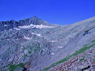
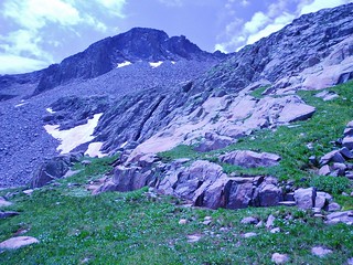
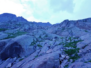
Gladstone Peak taunting us as we stand near the base of Wilson Peak.
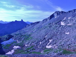
The Unnamed Lake at 12,060 ft and the view of Lizards Head
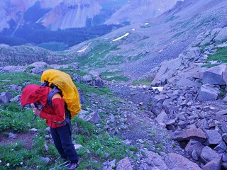
After a serene evening in Upper Bilk Basin, we awoke to sky full of stars. It was a good sign. Who knows, maybe it would be a clear day. I thought we had a really good chance for the summit, since we were only a couple miles away.
We arrived at the unnamed lake, at 12,060 ft at 6am. The lighting was flat and so the view of Gladstone and Wilson Peak was fuzzy. We headed up to the obvious saddle between Gladstone and Wilson Peak, getting suckered by some cairns.
Then, as we neared the base of Wilson, we realized we were too far from Gladstone. We were hoping to hit the ridge only 0.5 miles from the summit of Gladstone…and now we were about a mile away!
Oh no! My heart sunk. We had wasted quite a bit of time. We looked at the long ridge separating us from our destination and it just looked icky. Rather than take a chance traversing the entire ridge, we descended back to the lake to try again. Maybe in the brightness of full sun, we’d see the proper route.
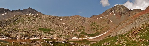
Panorama taken from the Lake, showing Gladstone Peak on the left and Wilson Peak on the right!
So, here’s my beta for the summit of Gladstone Peak, from the unnamed lake at 12,060 in Upper Bilk Basin. Keep in mind, these were taken out of order from how they’re displayed here! I took most of these shots on the way down, once I knew the route would go.
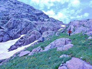
From the panoramic picture above, there is a long grassy bench above the lake. Head SW of the lake, aiming for this grassy bench.

As we were heading up the grassy bench, I turned around and got this shot of the lake. It took us about 25 minutes to get here, from the lake.
This picture is at: GPS: 37 deg 51.201′ N by 107 deg 58.543′ W, at 12,176 ft.
Once on the grassy bench, head towards a waterfall, to the south. Trend upwards on grassy ramps, until the grass runs out.
This picture was taken at the end of the grassy bench, zooming in on the direction of the waterfall. All the terrain in this shot is more than 4th class, so the hidden gully appeared to be the last chance we had of getting into the rocky basin below Gladstone.
The next crux involves a 3rd class move with a foot jam in a crack.
GPS for the 3rd class step up: 37 deg 51.098′ N by 107 deg 58.527′ W at 12,205 ft.
After this move, you go up into a hidden grassy gully (I call it hidden because initially we couldn’t see it from the big grassy bench). At the top of the gully, you are led to the rock basin at the foot of Gladstone Peak.
Here is the hidden grassy gully (after the 3rd class step-up). When I took this picture, I was standing at:
GPS: 37 deg 51.094′ N by 107 deg 58.544′ W, at 12,249 ft.
Here’s a picture from the top of the hidden grassy gully, looking back down it…
GPS: 37 deg 51.108′ N by 107 deg 58.616′ W, at 12,434 ft.
Here’s a picture looking at the route ahead, from the top of the hidden grassy gully. There are a bunch of rocks and little benches. Just find the easiest path which is leading SW and head towards:
GPS: 37 deg 51.073′ N by 107 deg 58.627′ W at 12,509 ft.

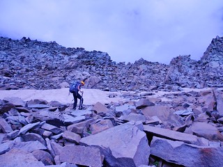
Once you get into the rocky basin below Gladstone, you get a great view of the ridge! It took us about 45 minutes to get here, from the lake at 12,060 ft. If you know the way, you could probably shave off 15 minutes.

Keep heading SW into the rocky bowl and when you get to this boulder, you can decide which way you want to ascend to the ridge. The position here is:
GPS: 37 deg 51.033′ N by 107 deg 58.846′ W, at 12,606 ft.

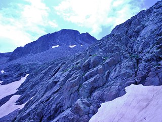
Looking up at Gladstone and it’s North Ridge. There are two main ways of achieving the ridge:
One is to skirt around the cliff band and head for the black streaked section of rock. We actually came down this way and it wasn’t as bad as it looks from below.
The other way is to head for the low point on the ridge (to the right of picture frame) and climb to the summit of Gladstone from that spot. We took this approach and it worked fine.
On the way up, we cheated by dropping off the ridge, on the left side in a few spots. Mainly because we saw a guy traversing on social trails, who was about 300 feet down below the ridge. However, I would recommend staying on the ridge (or as close to on the ridge as possible). Many of the social trails beneath the ridge are loose and the rock above may come crashing down…whereas, from above, you can test out the rock as you go.
On the descent, I was curious if I could stay entirely on the ridge, without dropping off and the answer is yes. Even though there were sections which looked like it wasn’t going to go, there was always a way around the micro cruxes. It was actually much more enjoyable than getting involved with the chosspile side slope below the ridge!
So, maybe the best route on the North Ridge would depend upon the level of ones scrambling skills, ones balance, and ones reaction to exposure. For me, these are my strengths, so I’d rather take the ridge!
Here’s Helen going for the low point on the ridge.

Here’s Meredith climbing to the saddle. I like this picture because it shows the steepness.

Finally, we gained the North Ridge! It took us 1 hour and 20 minutes from the lake at 12,060 ft.
The GPS coordinate of this picture is 37 deg 51.046′ N by 107 deg 59.246′ W. It is at 13,129 ft.

Taken from the same spot as the last picture, just looking Northeast to Sunshine Mountain.

And, yet, a third picture from the same spot. Showing the objective, about 0.5 miles away!
As you can see in this picture, clouds were starting to form in the sky. We hurried along the ridge as fast as we dared. At times it sprinkled bits of rain. But, we continued to make excellent progress, in spite of the increasing humidity.

It took us about 1 hour and 15 minutes to reach the summit. Just before the final push, the last 10 minutes of climbing, I got this shot of Mt. Wilson. The storms were definitely focusing their energy on Mt. Wilson and El Diente. Both peaks were getting hammered with rain. Luckily, we weren’t hit with the deluge. And, we never saw lightning or heard thunder; another gift from the gods!

Here’s Helen maneuvering around boulders on the North Ridge. We’re now only 10 minutes from the summit. The brown streaked saddle way behind her is the Rock of Ages Saddle, which one goes over if coming from the Silver Pick Basin.

Wilson Peak, just below the summit of Gladstone! After spending so much time around the base of Wilson Peak, and now seeing the whole mountain from up high, I really wanted to climb it. Maybe, if I get lucky, I can do it before the end of this summer!
Just below the summit, I decided to traverse out onto the east side. A young man was on the top and he wanted to come down, so I moved over there in order for him to make his way down.
As I traversed over there, I stepped on a boulder the size of a coffee table and the boulder started sliding out from under me. Quickly, I jumped onto another boulder, and that one started rolling. Desperately clutching for anything, I kept hopping and clawing my way up until finally I was on something solid. My heart was racing.
The young man stood there gaping at the massive rockslide. It went on for several minutes and we could smell sulphur from the pulverized rock. When it ended we just looked at each other in awe. I was lucky to be alive. He gave a congratulatory nod, for the summit achievement, said to be safe, and then darted downward. Pretty soon, I was joined by Helen and Meredith, who were both happy to see me in one piece.
We stayed on top just long enough to take some pictures and then we descended.

Helen Celebrating on Gladstone Peak

Me after cheating death, with Mt. Wilson and El Diente behind me. I was still shaking with adrenaline when we were dropping off the ridge. It took me about an hour to really calm down and digest what had happened. Gladstone is a dangerous peak. Stay on the ridge as best you can and don’t (whatever you do) stray…even if you are only 20 feet from the summit!

Meredith on the top of Gladstone Peak

Summit Selfie with Helen and Meredith

Heading back down the rock basin. It sprinkled a tiny bit on the way back to the tents, but nothing substantial. We really lucked out with the weather!

Mt. Wilson disappearing behind a rib of rock.
I was packing up my tent when an old man walked by me. He had been hiking in the Bilk Basin, up to the lake. Apparently, he does the hike several times throughout the summer as he enjoys the views. I asked him if he had ever climbed Gladstone and he said, “Gosh no, it’s dangerous! Why, even today, there was a huge rockslide!”.
He then asked me if I had seen the rockslide or heard it. He said it was one of the biggest slides he’s ever seen and he hoped nobody was hurt.
I felt my face flush with embarrassment. “Well, actually, funny you mention it…”.
I confessed to be the culprit and told him that it was scary and I was thankful to still be alive. He told me to go buy a lottery ticket. We had a chuckle and then he took off, with his circa 1980’s Jansport backpack slung over one shoulder…
The hike back to the car was uneventful until we got to the creek crossing! Some nice person had put a second log over the creek, so now it was much easier to cross, vs. having only one log.
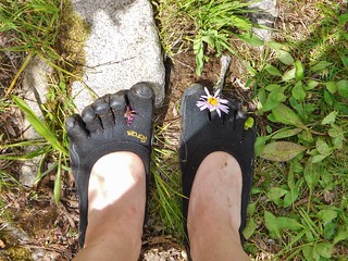
Because the trail is so nice, I wore my VFFs on the way out. These have a habit of collecting samples of flowers in between the toes, which I find delightful.

Here’s Helen crossing the creek. She preferred walking across the log jam, while Meredith and I preferred crossing over the shorter, more direct logs. Both ways worked!
And, finally, for completeness, here is the topo map, with key waypoints:

Tags: 13'er, Backpacking, Bilk Basin, Centennial, CO, Gladstone Peak, Lizard Head Wilderness, San Juan Mountains, Scrambling, Sunshine Mesa Trailhead, Telluride