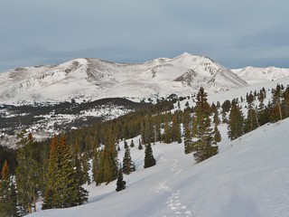
Bross, Cameron, and Lincoln from Scott Gulch.
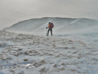
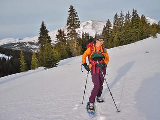
Erin fighting to stay vertical en route to Mt. Silverheels.
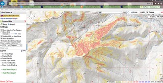
Cal Topo Map of Slope Steepness, for avalanche preparedness.
Erin and I failed miserably at ascending Mt. Silverheels. We properly mitigated all the objective hazards, but nothing could account for the onslaught of perpetually high wind. It was blowing much stronger than what I experienced with Slava on Longs Peak and I wouldn’t be surprised if it was gusting between 90-100 mph.
I fell over 3 times and I dared not drop my pack for fear that I would land in Oz. The forecast was for high winds gusting between 30 and 40 mph. Next time I try this mountain, I’m only going to go if the forecast is between 0-10 mph gusts…that way if they are off by 50 mph, then I might actually be able to summit!
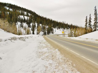
Looking back at the bend in the road, on HWY 9, where you park the car. For Scott Gomer gulch, park just around the bend, on the right. The pullout is huge and there is room for tons of cars.
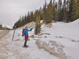
To start the trip, hike back up the road (towards Hoosier Pass) to where there is a path leading into the forest on the right. In the picture above, Erin is pointing to the trail.
Follow Scott Gulch as it winds it’s way uphill. We stayed about 200-300 ft above the actual gulch while we were hiking below tree line. There’s no need to be in the gulch. Eventually, the gulch steepens and gets more defined as one approaches tree line.
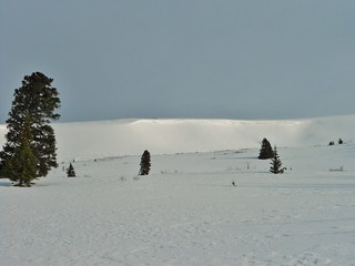
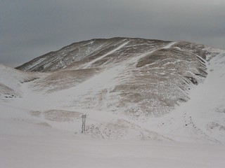
Upon emerging from tree line, look left to see Hoosier Ridge. In winter, it can be heavily corniced!
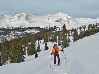
From the same spot as the last picture, I looked down Scott Gulch and got this rad shot of Erin with Mt. Bross and Mt. Lincoln.
Right behind the large pine tree is the narrowing bit of Scott Gulch. I couldn’t get a good shot of the gulch because the sun was shining right in the lense…
Here’s Erin, taken from the same spot as the one before, just looking down canyon.
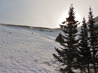
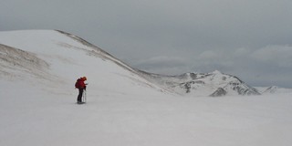
In between Hoosier Ridge and Point 12,420 ft, there is a saddle where the Scott Gulch begins. From the saddle, one can see Mt. Silverheels. It’s a bit daunting in winter, especially on such a dreary day. Even though we nearly got blown over in this saddle, we decided to press on in the hopes that things would improve. I gave it one more hour.
We ended up making it about 1/3 the way up the mountain before finally giving up. The wind was really unbearable. It was difficult to eat or drink anything without risking exposure to the frostbite. Plus, there is no shelter along the way and the retreat is not easy due to having to climb back into Scott Gulch. In conditions like these, the best decision is to go home. The mountain will be there tomorrow.
Here’s Erin at the Saddle. This was actually taken on our retreat back to the car; after fighting 2 hours of seriously awful wind.
What a bummer to not summit; but our success was in returning without frost nip or worse!
Tags: 13'er, Attempt, Centennial, Mountaineering, Mt. Silverheels, Snowshoe Hike, Tenmile Range