Posts Tagged ‘Trail Running’

Trail Running – My Sawatch Sufferfest – 4 Mountains in a Day

Saturday, August 16th, 2014

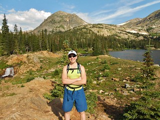
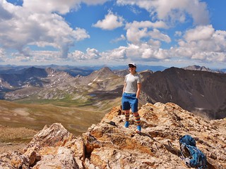
Smiles on Mount Belford
Climbergirl in the middle of her Sufferfest
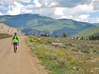
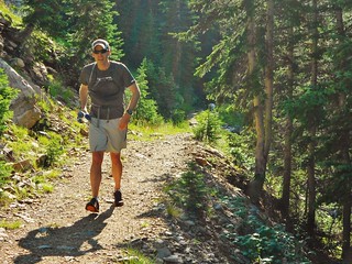
Doug Ends His Sawatch Sufferfest
Doug at the end of his Sufferfest

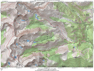
On Saturday, Doug and I decided to tackle a conglomerate of mountains in the Sawatch range. There happen to be 5 co-located mountains, which are all centennials (among the top 100 highest peaks in Colorado). Many people hike 2 of them in a day, fewer will do 3 in a day, and even fewer will do 4 or more. Since Doug and I are both training for ultras, we set out to do all 5 in a day.
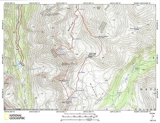
My Sawatch Sufferfest Topo Map
My game plan was to do the loop and return to the Missouri Trailhead. At the end of the loop, Doug would drop off the side of Oxford and connect with the Colorado Trail, run for an additional 8 miles, and head back to the road. I would drive the truck from Missouri TH to the CO TH and pick him up, saving him a 5 mile gravel road run at the end of the day.

If everything worked out right, I wouldn’t have to wait for him and we’d both have a great day of training.
(more…)

Deception Pass 50K Trail Ultramarathon

Sunday, December 15th, 2013

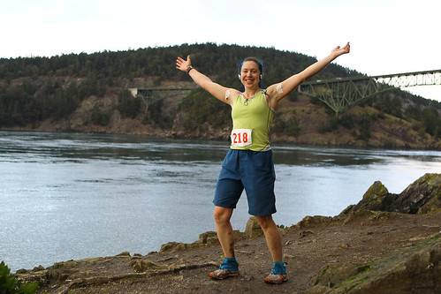
At Mile 29 of Deception Pass 50K
Picture Courtesy: Glen Tachiyama

On Sunday, I ran the Deception Pass 50K Trail Ultramarathon, held by Rainshadow Running. It was some of the most amazing trail running I have ever experienced. The course is designed with several lollipop loops, so as a middle of the pack runner, I frequently was cheered on by the lead pack as they passed me. The party at the end of the race was great; food and beer was amply supplied.

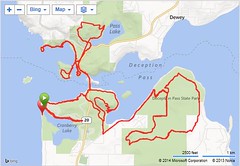
Deception Pass Route Map

The Pacific Northwest is known for it’s lush and verdant environment and this race did not disappoint. I ran through groves of ferns which were taller than me and under thick canopies of trees so dark that I wished I had a headlamp! The trails were soft underfoot and, in all but one section of the race, fairly free of mud swamps.

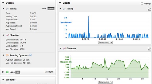
Deception Pass Elevation Profile, Speed, Gain

There were 185 racers and I came in 105th place. Out of the females, I came in 31 out of 87. I was happy with the race result, even though it took me about 45 minutes longer than expected.
(more…)

Deception Pass 50K Trail Ultramarathon – Why Do It? and My Training

Thursday, December 12th, 2013

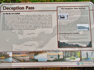
Deception Pass Signage
I decided to run another trail Ultramarathon, since I had so much fun at Way Too Cool earlier this year. I picked the Deception Pass 50K, on Whidbey Island in Washington State.

Why I selected this race, over the others:
1. It is almost entirely on single track, with only a small amount of pavement involved.
2. It is small, with less than 200 runners total.
3. It is at sea level.
4. It is right before the holidays, so I will be able to enjoy ski season without having to train throughout the winter.
5. It is affordable, being only $65 bucks.
6. It is not an out and back, so I will not be bored.
7. I get to run across a bridge!
8. It is unlikely to be over 70dF or under 20dF.
9. I get to visit with family before the race.
10. It is an incredibly beautiful setting!

Here are the numbers of minutes I ran every week, while in “training mode”. Prior to the 3 months of training, I spent all summer climbing mountains…24 to be exact. So, my legs were in very good condition prior to the training period.

Week 1: 275
Week 2: 350
Week 3: 60 (I was sick)
Week 4: 405
Week 5: 430
Week 6: 540
Week 7: 320 (I was sick, again)
Week 8: 570
Week 9: 490
Week 10: 380
Week 11: 350
Week 12: 470 (This includes the race itself!)

A big shout out to my coach, Lea, for devising the custom weekly training runs and keeping me focused. Also, to my friends Tilden, Dan, Kristina, and Erin for running with me during training. Most important, thanks to Dennis for providing me with aid, both nutritional and emotional, during training and the race. My success is a reflection of your care and support!

Trail Running – Peavine Peak Halo Trail, Reno, NV

Saturday, November 2nd, 2013

Dennis and I took a trip to visit family in Reno, NV. While we were there, I had to do a 3 hour training run on trails, with quite a bit of elevation gain. After a few emails to Reno friends Dylan and Charles, I determined the trails on Peavine Peak would be suitable. More specifically, I set out to do the Halo Route which is ~13 miles with ~1500 ft of gain.

I was pointed to the Poedunk Mountain Bike Club as a source for more information regarding the trails. They had trail maps and elevation profiles of various routes available, for easy printing. Also, for pictures, and more information about the Halo trail, check out blogger Nevada Rambler’s Awesome Trip Report.

On the day of the run, it was around 40dF at the start, partially clouded, with a slight breeze. Perfect! Dennis dropped me off at the trailhead and I started running in a clockwise direction. I missed some of the turns during my run, but somehow managed to find my way back to the trail. The trail is very nice for running, with no roots or major obstacles. Also, it is high above Reno, so you get sweeping views of the city and surrounding mountains.

I had a fabulous time running on Peavine and would highly suggest this area to other trail runners! The local mountain bike community has devoted a lot of time to trail maintenance, and it shows! On my way out, Dennis and I ran into Lee Turner who is an avid mountain biker and backcountry skier. Lee was telling me about Poedunk and encouraged me to get the word out about the organization. So, thanks to Poedunk for their hard work, coordinating efforts with the local forest service, and dedication to the trails!

Trail Running – High Lonesome Trail Loop, Hessie Trailhead

Saturday, July 27th, 2013

Tilden Running on Devil's Thumb Pass Trail
Tilden Running on Devil’s Thumb Pass Trail

On Saturday, Tilden and I ran the High Lonesome Trail Loop; up Devil’s Thumb Pass, across the Continental Divide, and then down the King Lake Trail. It took us about 5.5 hours, with an average rate of 20 minutes per mile (including the uphill portions!).

Clare at Devil's Thumb Lake (11,100 ft)
Climbergirl At Devil’s Thumb Lake (11,100 ft)

I was very happy with the run, as I haven’t been running in a while, outside of the occasional 20 minutes in the gym. My knee was bothering me a little bit on the way down, but other than that, no other problems.

Also, bonus points for Tilden. He brought his water filter, so we never had to carry more than a liter of water which really made the run go more smoothly. Not having to carry the extra weight was super nice!

High Lonesome Loop TOPO Map

The High Lonesome Loop is roughly 16.4 miles with several thousand feet of gain, in an amazing alpine setting. I would estimate about 85% of the run is on single track, with the rest being on a gravel road.

(more…)