Archive for the ‘Mountaineering’ Category

Mt. Evans Via Right Side of 2nd Apron (5.6)

Saturday, August 2nd, 2008

Clare & Dave Victorious

On August 2nd, I met up with Dave and we climbed the 2nd Apron of Mt. Evans, 5.6. It was a gorgeous day for climbing. Dennis met us at the top, after ascending via a ridge hike, and we three hitched a ride back to Summit Lake.

Dennis Happy to be on a Sunny Summit

This climb has several good qualities, a short 30 minute approach, 5 pitches of beautiful lichen spotted granite Alpine climbing, a spectacular ridge topout, high altitude exertion, and fantastic views.

IMG_3961

It took us between 2.5 and 3 hours to complete the route in 5 pitches. The last pitch is not really necessary to rope up, if one is experienced and comfortable bouldering. We took a #1-#3 cams, aliens, a few metolius tcus, and a set of large cams. Nothing special required.

(more…)

Day Hike – Solitude Lake – Glacier Gorge TH

Sunday, July 20th, 2008

Clare at Mills Lake (9,955') Dennis at Solitude Lake  (11,400') Long's Peak, Keyboard of Winds, Pagoda, Spearhead, & Chief's Head
On Sunday, Dennis & I did a hike up to Solitude Lake (11, 400′), in an effort to climb Thatchtop Peak (12,668′). (more…)

Day Hike – Hallet’s Peak (12,713′)

Sunday, July 13th, 2008

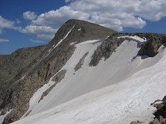
Hallet's Peak & Tyndall Glacier

Dennis & I hiked to the top of Hallet’s Peak (above) via Flattop Mountain (Below). The 10 mile hike took us 5.5 hours (11:30am to 5pm) and we had about 3,400′ of elevation gain.

Tyndall Glacier & Flattop (mid right)

I wonder why Flattop is distinguished as a separate mountain, when it seems to me it is a plateau. What are the USGS specifications for classification of mountains?

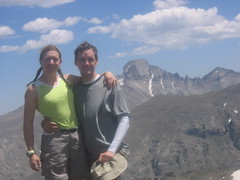
Clare & Dennis Summit Hallet's Peak, Long & Pagoda Peak in Background
(more…)

Ypsilon Lake – Lawn Lake TH

Saturday, July 5th, 2008

Ypsilon Lake Signage Clare at Ypsilon Lake (10,665')

Dennis & I hiked up the Ypsilon Lake Trail, starting from Lawn Lake Trailhead, RMNP. It is a moderate hike, up a ridge to a pretty alpine lake. The hike is ~9 miles round trip (to Ypsilon Lake) with 2,378′ of gain. The highest altitude achieved is 10,772′.

Check out Protrails for further information. (more…)

Day Hike – Mayflower Lake Base of Mt. Helens

Sunday, June 15th, 2008

Rachel & Clare in front of Mt. Helens Clare at Beaver Pond, Mt. Helens in Background
Beautiful Vista

Rachel & I hiked ~4 miles to the base of Mt. Helens at Mayflower Lake, just outside of Breckenridge. We went down the wrong path, and ended up on the wrong side of the mountain…but we met a nice guy from Baltimore who showed us his topo. He also shared his chocolate chips and reminded us it was Father’s day…OOPS!!! (more…)