I ran with Barry & Anne from the North to the South Rim of the Grand Canyon. It is 24.4 miles of running with over 10,000 ft of elevation gain/loss. Start: 4am and Finish:12pm (Anne finished at 1:40pm). With 4 bathroom/snack breaks and a stop to tape my hideously sprained ankle, running time was ~7 hours. A most excellent adventure!!!
GPS Elevation & Speed Plots:
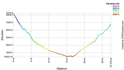
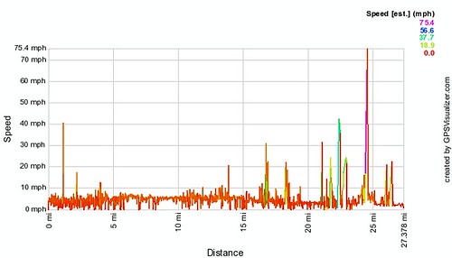
Please be aware, there’s error in almost every data point for the ascent of the South Rim. As a result, the speed & elevation profiles show that we went 27 miles instead of 24.4. Dennis & I spent several hours reducing the error (as it falsely reported we had run 30 miles)! I did not feel like spending any more time with it, so please forgive the data innaccuracy!
R2R Video: