Posts Tagged ‘CO’

Mountaineering – Lackawanna Peak (13,823 ft)

Sunday, February 8th, 2015

Lackawanna Peak Summit Picture
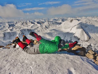
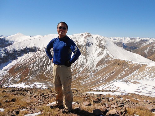
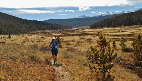
Clare, Tom, and Frank on the summit of Lackawanna Peak

Climbing South Slopes of Lackawanna
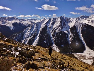
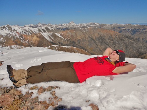
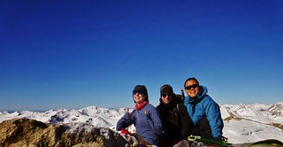
At ~12,000 ft on the direct south slope of Lackawanna

Tom Climbing Lackawanna
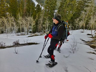
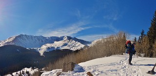
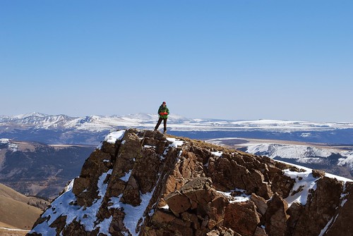
Tom climbing the lower slopes of Lackawanna. You can see hwy 82 below him.

Lackawanna Peak Topographic Map and Waypoints
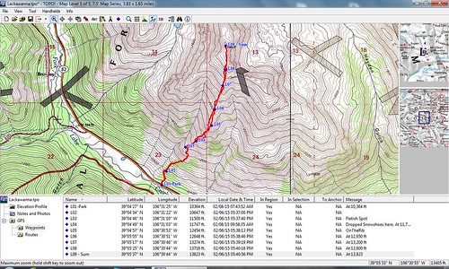
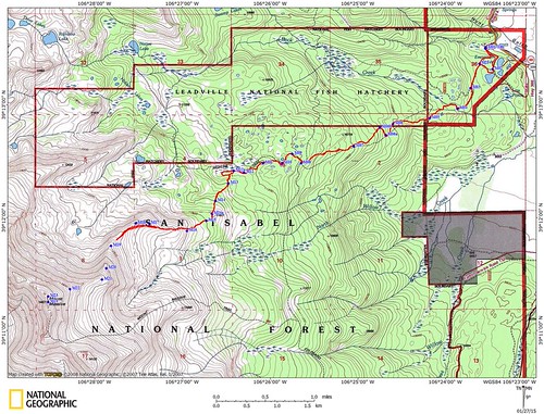
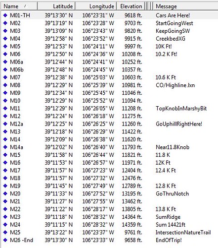
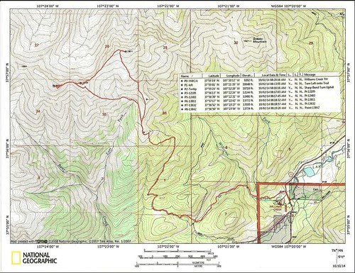
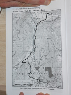
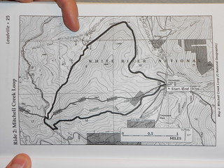
The Route and GPS Waypoints

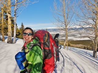
Good times were had by Tom, Frank, and Clare on the Lackawanna legburner route, which was climbed on Sunday. The 4 mile round trip journey featured 3,450 feet of gain! It took us 6 hours to get up the peak (mainly due to the deep snow over the first half of the route) and 4 hours to get down. I was very thankful to Frank, who both supplied the pictures and drove us there!

(more…)

Mountaineering – Mt. Massive via East Ridge, A Winter Attempt

Sunday, January 25th, 2015

Mt Massive East Ridge
David, Jane, and Sonja Ascending the East Ridge in Gale Force Winds

Sneak Preview of Massive
Mt. Massive (Taken the day before!). The Lower portion of the East Ridge is blown free of snow.

Mt. Massive East Ridge - Topographic Map
Our Route, the East Ridge, (Failed Attempt in Red).

The Crew: Jane, David, Sonja, and myself.
Launch Time: 6am
High Point Turnaround: 11:40am (from ~12,700 ft)
Trench Contribution: (~1 mile)
Return to Fish Hatchery: 3:10pm (~9,620 ft)

We enjoyed a fabulous winter day in the beautiful mountains of the Sawatch. We had high hopes for summitting Mt. Massive, but were thwarted by gale force winds up high on the East Ridge.

Mt Massive East Ridge GPS Waypoints
The Waypoints!

(more…)

Mountaineering – Mt. Elbert (14,439 ft)

Saturday, January 17th, 2015

Winter Camping Gear Schmear
Gear Schmear, for Winter Mountaineering trip up Mt. Elbert

Approaching 11,000 ft on Mt. Elbert
At 11,000 ft and almost to our camping spot. Enjoying the bluebird day.

Mt. Elbert and Bill
Bill, the CMC Trip Leader. He’s taking a breather before we reach camp. Elbert stands tall behind him.

Silly Summit Shot on Mt. Elbert
Flying High on the summit of Mt. Elbert!

I wanted to try winter camping and I hadn’t yet climbed Mt. Elbert. So, why not join Bill’s CMC trip which would combine both elements? Bill is leading a trip to attempt Aconcagua later this year, so this trip was a warm up and test of sorts for his participants. Lucky for me, there was a last minute cancellation on his trip, which opened up a space for me, AND my friend, Helen, needed a partner for her tent. It was almost like I was meant to be on the trip, all along!

(more…)

Mountaineering – Pt 13,811 and Pt 13,832 – San Juan Mountains, CO

Sunday, October 5th, 2014

Panorama From Williams Creek Trail
Lovely Fall Day in the San Juans!

Napping on Pt 13811
Time for a rest on the summit of Pt 13,811!

Clare in the San Juan Mountains
On my way to Pt 13,832 (Thanks to Frank for such an awesome picture!)

Frank on Pt 13832
Frank standing proud on Pt 13,832.

Pt 13811 and 13832 Topo Map with Waypoints
Our Route!

After my 20+ mile run, I took a rest day with Dennis in Leadville. We enjoyed a leisurely morning and used the dry sauna at the hotel. Then, we went to the Museum of Mining. Dennis used to work for MSHA and I really enjoy geology, so it was pretty fun.

Later in the day, we met up with Frank in Buena Vista. I hopped in Frank’s car and Dennis headed home. Frank and I then drove to the San Juans to join the 14ers Fall Gathering. We were excited to meet some other mountain enthusiasts and our goal was to climb “The Points” which are two centennial 13ers just outside of Lake City. (more…)

Trail Running – Camp Hale to Tennessee Pass and Mitchell Creek Loop

Friday, October 3rd, 2014

Running Down Colorado Trail
Gotta Love Running in the Rockies!

I was supposed to climb Mt. Elbert, but with forecasts of extremely high winds, I decided to bail. I’d rather do a lovely trail run, in treeline, than be blown around, all by myself, on the top of the highest mountain in Colorado.

5.4 Miles Into Camp Hale to Tennessee Pass Trail
Dennis with his Bike

Dennis was planning to do a 20+ mile bike ride, from Camp Hale up to Tennessee Pass and then around the Mitchell Creek Loop. The lollipop bike ride looked like a lot of fun; part of it is on the CO Trail so trail conditions were destined to be good.

So, I decided to join Dennis. He would ride and I would run. Fun! Maps below are courtesy: Arkansas Valley Mountain Biking by Mark Wolff. Buy the book, it’s great!
Camp Hale to Tennessee Pass Topo
Camp Hale to Tennessee Pass Topo Map

Mitchell Creek Trail - Loop Hike
Mitchell Creek Loop Map

(more…)