Archive for the ‘Mountaineering’ Category

Mountaineering – Longs Peak (14,255 ft) via the Keyhole

Friday, March 14th, 2014

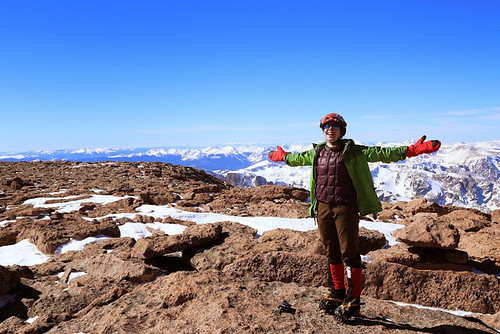
Slava on Longs Peak Summit
Slava on Summit of Longs Peak

Super Psyched on Longs Peak
Climbergirl Conquers Longs Peak

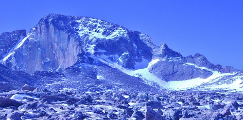
Longs Peak and the Keyhole from Boulderfield
Our Destination, From the Boulderfield

On Friday, Slava and I took advantage of the clear weather and climbed Longs Peak. Originally, our plan was to climb Mt. Lady Washington, but since the weather was gorgeous and we were making excellent time, we decided to go for the summit of Longs Peak instead.

We ascended the ever popular Keyhole Route. It was my first time climbing Longs Peak, so I was excited to do this route in winter when there would be no crowds. Additionally, the element of snow and ice made the route more challenging and I enjoyed the added technicality of climbing with crampons.

(more…)

Mountaineering – Atlantic Peak (13,941 ft)

Sunday, January 19th, 2014

Climbergirl and Nerdysheep on West Ridge of Atlantic
Rather than loafing around all day, watching the Bronco’s play the Patriots, Erin and I decided to go climb a mountain.

I stole Dennis’ Bronco shirt as a token of our support. My plan was to wear it on the summit!

Erin Enjoying Exposure on Atlantic West Ridge
In order to get there, we would need to climb 2900 feet of gain with a total trip distance of 5.4 miles, negotiating snow drifts, potential avalanche spots, and cornices.

The question is; would we conquer the mountain without succumbing to Old Man Winter?

Mayflower Gulch Basin
Pacific Peak Bathed in Early Morning Sun and the long, mellow angled ridge of Atlantic, in the foreground. Mt. Fletcher is off to the right, connected to Atlantic by a foreboding snaggle-toothed ridge!

I had my eyes set on the west ridge of Atlantic ever since reading about it in Mr. Cooper’s Colorado Snow Climbs book. Having been into the Mayflower Gulch on a prior attempt of Mt. Fletcher, I was familiar with the area; one of convenience and beauty!

(more…)

Mountaineering – DeCaLiBron via North Ridge of Mt. Democrat

Saturday, September 21st, 2013

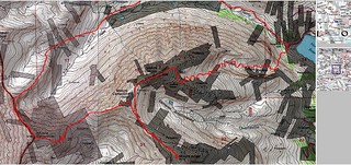
DeCaLiBron Loop TOPO Map
DeCaLiBron Loop Hike Topo, Via North Ridge of Mt. Democrat

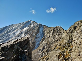
Mt. Democrat North Ridge
The North Ridge of Mt. Democrat, oh that it were longer! 0.5 miles of fun scrambling does not make up for the 6+ mile boggy approach.

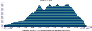
DeCaLiBron Loop Elevation Profile
This elevation profile is not quite accurate. 4900 ft is in the right ballpark, for the elevation gain, but the distance is short by about a mile!

Doug and I decided to squeeze in a few more 14’ers before winter and so we aim for DeCaLiBron (De=Democrat, Ca=Cameron, Li=Lincoln, and Br=Bross). I’m not sure why it’s called DeCaLiBron and not DeCaLiBross, but that’s a topic for some other time.

To make it more interesting, we decide to climb the north ridge of Democrat, then climb Cameron, Bross, and Lincoln. Ending the day by descending the Lincoln Amphitheater, to get back to the truck above Montgomery Reservoir.

Launch: 5:50am
Begin Mt. Democrat North Ridge Scramble: 9:40am
Summit Mt. Democrat: 10:40am (We take a short lunch break on the summit).
Summit Mt. Cameron: 11:40am
Summit Mt. Bross: 12:20pm
Summit Mt. Lincoln: 1:12pm
Begin Descent of Mt. Lincoln via the Amphitheater: 1:25pm
Finish: 4:15pm

(more…)

Mountaineering – Ellingwood Point and Blanca Peak, Sangre De Cristo Wilderness, CO

Saturday, August 31st, 2013

Knife Edge of Ellingwood Point?
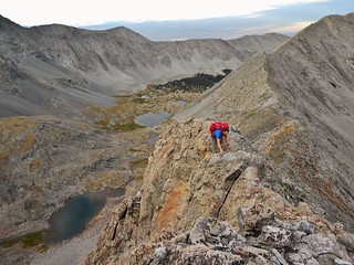
Doug Climbing the Southwest Ridge of Ellingwood Point

Doug and Clare Summit of Ellingwood Point
Summit of Ellingwood Point (14,042) after climbing the Southwest Ridge.
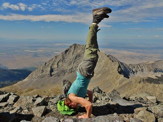
Blanca Peak Headstand (14,345 ft)
Summit of Blanca Peak (14,345 ft) after traversing the Northwest ridge from Ellingwood Point.
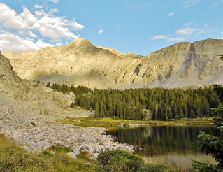
Lake Como Road - 3 hrs of Hiking - Lake Como!
Lake Como and the eponymously named “Road”, left of frame. If you’re having trouble seeing the road, because of the boulders, it’s because the road *is* the boulders!

For an excellent recap of the Lake Como Road, I entreat you to watch the following awesome video, by Rockfrogs 4WD Club. These guys demonstrate extreme skill maneuvering their tricked out trucks up that road! It is one of the most challenging roads in our country, and they manage to get their trucks past Lake Como, all the way up to Blue Lakes. Amazing!

On Friday, Doug and I drove from Denver to the Lake Como Trailhead, were delayed by a train for 20 minutes on the way there, hike up the arduous Lake Como Road, scope out the start of the climb, and then set up base camp at Blue Lakes.

Saturday we tackle the Southwest Ridge of Ellingwood Point, traverse to Blanca Peak along the Northwest Ridge of Blanca, climb Blanca Peak, descend to base camp, pack up, hike back to the truck, and drive back to Denver.

It takes us approximately 24 hours to complete our mission, from the time we leave the truck until the time we return. The trip was hectic and frustrating at times; but supremely rewarding and gratifying, as well. We travelled roughly 15 miles with 6,500 ft of gain.

If the Southwest Ridge of Ellingwood Point were more easily accessible, it would be completely plastered with scramblers every day! The rock on this ridge is of high quality and, for the most part, secure. The position of the route and the exposure produces an extremely enjoyable route! Do IT!

Thank you to skier25, who posted a fabulous trip report, with pictures, of the Ellingwood Point – Southwest Ridge on 14ers.com!

(more…)
Mountaineering – San Juan Peak Bagging Extravaganza, Day 3

Saturday, August 17th, 2013

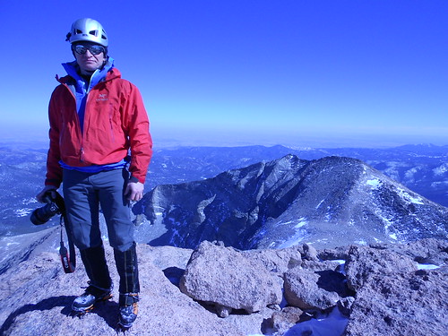
Day 3 of SJPBE did not start out very well. It was raining at 4:30am. So we slowly got things ready while it was raining. We were not excited about hiking in the rain. Finally, around 6am, it cleared up a little and became just a slight sprinkle.

Good enough! We charged down the road; two girls on a mission. We had no idea how our day would go, we just knew it would be a good day!

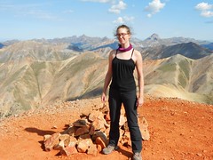
Summit of Redcloud Peak (14,034 ft) Erin All Fired Up on Redcloud Peak (14,034 ft)
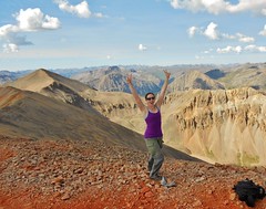
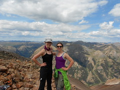
Clare and Erin all fired up on Redcloud!

Erin and Clare Walking on Sunshine (14,001 ft)
We’re Walking on Sunshine…Yeaaaaah!

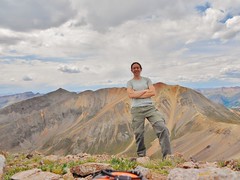
Clare on Summit of Pt 13,832
On Summit of Pt. 13,832 (A Centennial) with Sunshine and Redcloud behind me.

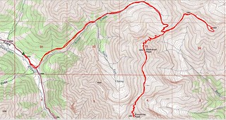
Redcloud, Sunshine, Pt 13,832 Topo Map
Map of Approximate Route

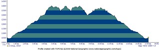
Redcloud, Sunshine, and Pt 13,832 Elevation Profile
Elevation Profile showing 15 miles total with 6,300 ft of elevation gain. Whew!

(more…)