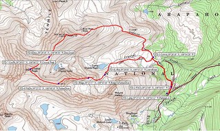
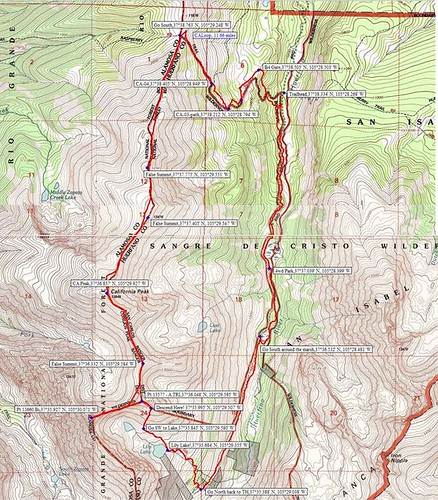
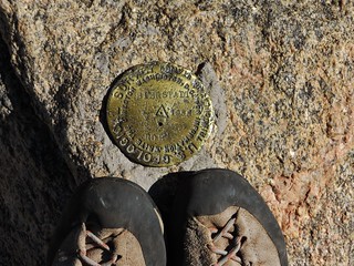
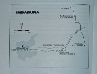
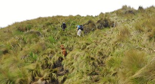
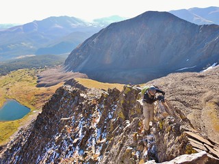
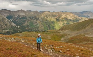
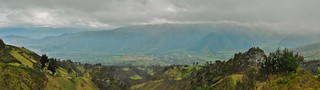
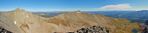
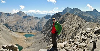
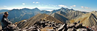
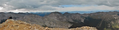
Posts Tagged ‘Hiking’

Ecuador Day 5 – Imbabura Summit Rim (14,764 ft)

Monday, November 24th, 2014

Imbabura Map
The Map

Rafael, Tilden, and our Perra
The Approach

Imbabura View in the Morning
The View

Clare Near Imbabura Summit
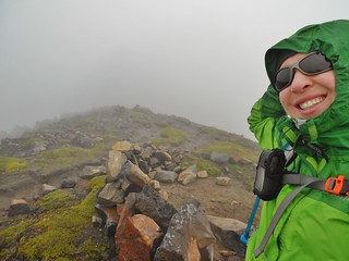
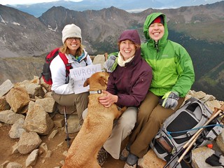
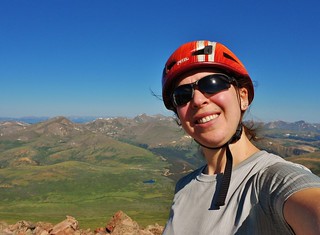
What I Thought Was the Summit!

Our next mountain, Imbabura, is the prominent mountain of Otavalo. According to Yossi Brain, “A large hill with a long walk up it, Imbabura is good for acclimatization and fitness.” I have to agree. The route we took ascended 3,905 ft and took us just over 4 hours to accomplish. At the time, I thought it was the summit, but later we figured out that we were on the summit ridge (since it’s a volcano, it’s not obvious if you’re in a cloud, to see the highpoint!). (more…)

Mountaineering – Crystal Peak (13,852 ft) and Bonus 13ers

Saturday, September 13th, 2014

Zach Clutching the Spine of Father Dyer

Smiles on Crystal Peak Summit
Zach, Beth, and Clare on Crystal Peak

Crystal Peak and Peak 10
Crystal Peak and Peak 10, taken from Father Dyer

Father Dyer, Crystal, and Peak 10 Topo Map with Waypoints
Our loop hike of Crystal Peak Cirque

In the Colorado Scrambles book, Mr. Cooper touts the climb of Father Dyer as, “a good introduction to the “art” of scrambling, offering some exposed but not sustained climbing and even a bit of loose rock to initiate the budding scrambler.”.

The climb of Father Dyer’s East Ridge sounded like a super fun way to climb Crystal Peak; a Centennial 13er just waiting to be ticked off our lists. Beth’s brother, Zach, is quickly building his scrambling repertoire, so this was a great route for honing his skills. By throwing in Peak 10 (13,633 ft), the #178 ranked Bicentennial as a bonus, we expanded the size of our loop hike and had a real feeling of accomplishment by completing the cirque. (more…)

Mountaineering – California Peak (13,849 ft) and Bonus 13ers!

Sunday, September 7th, 2014

California Peak Topo Map Waypoints
Our loop hike on California Peak!

Clare Smiling in the Sangres
Clare on the summit of Bicentennial Pt 13,660

Frank on Summit of California Peak
Frank on the summit of California Peak

After having to cancel my CMC trip for Mt. Meeker, due to heinous weather, I was left with a blank slate weekend.

What should I do? So many mountains to climb…how do I decide?

At the height of my mountain frenzy, I get an email from Frank and he suggests California Peak. Neither of us have done it, he’s been to the area and is willing to drive, we can car camp and don’t have to get up early, it’s…Perfect!

(more…)

Mountaineering – Huron Peak (14,003 ft)

Sunday, August 31st, 2014

Huron Peak Victory Shot

On Saturday, Crystal, Jen, Duke the dog, and I piled into the Subaru. Our destination was Huron Peak. Our plan was to car camp at the trail head on Saturday night. Starting at oh-dark-thirty would give us the best chance to make the summit.

Huron Peak Summit Panorama South
According to Mr. Dziezynski, “Huron is a classic climb on a picture-perfect mountain! This 14er may be the most beautiful hike in the Sawatch Range, with excellent views from the summit pyramid.”

Crystal at 13,000 ft on Huron Peak

It is for this exact reason, I selected Huron Peak as our destination. If successful, it would be Crystal’s first 14er, so I wanted her to be rewarded with excellent views. Also, Jen and her doggy Duke were there with us, so I wanted to pick a mountain with a clean, easy to navigate trail.

Starting in the dark, I wondered if the weather would comply…I dearly hoped so!

(more…)

Mountaineering – Mt. Bierstadt, Northeast Face Via Abyss Lake

Saturday, July 20th, 2013

Mt. Bierstadt USGS Summit Marker

Climbergirl on Summit of Mt. Bierstadt (14,060 ft)

Every weekend, there are hundreds of people summitting Mt. Bierstadt via the standard West Slopes, from Guanella Pass. I was purposely putting off climbing Mt. Bierstadt because of my dislike for encountering hoards of people in the wilderness. Back in 2008, I had climbed Mt. Evans via the 2nd Apron and that was super fun…until I got to the summit and encountered the masses.

Flexing Our Muscles Below the Sawtooth

In talking with Erin about this, she suggested we overnight at Abyss Lake and climb Mt. Bierstadt from the Northeast side. We talked about doing the Sawtooth over to Evans, while we were there, as it looked like a bunch of fun.

Doing Mt. Bierstadt via Abyss Lake, turns the experience into an overnight backpack, which adds a bit of adventure and a great deal of mileage. It was 23.4 miles round trip with about 4,600 ft of elevation gain.

(more…)